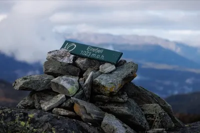
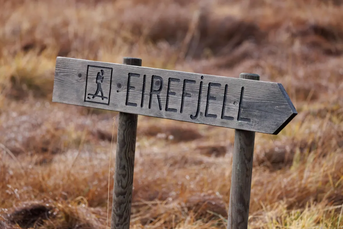
Eirefjell

Weather forecast
Hentar vêrdata…
Kjelde: Yr.no (Meteorologisk institutt)
Map and route
S Start
M Finish
▲ Highest point
▼ Lowest point
km Main route
↕ m Elevation
About this hike
Eirefjell (1023 m), Høydalsmo, Tokke.
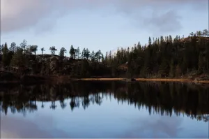
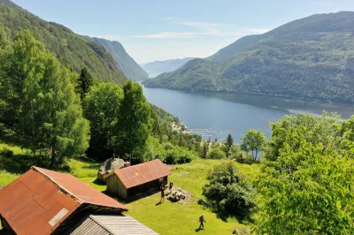
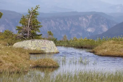
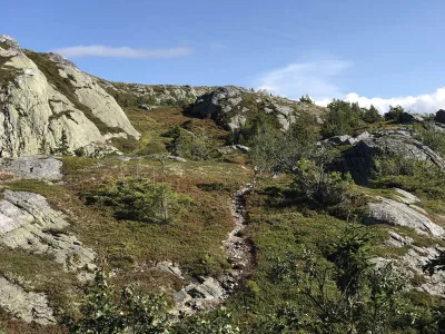
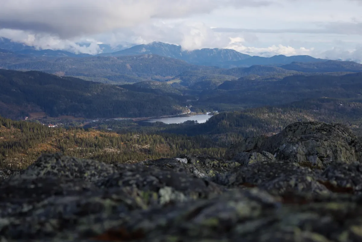
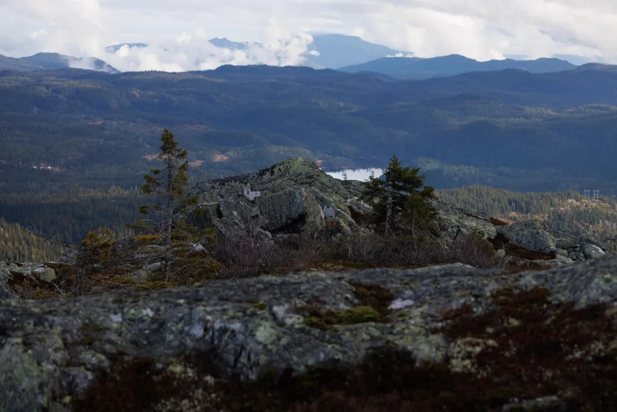
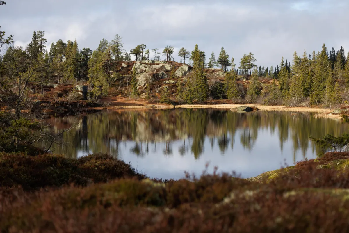
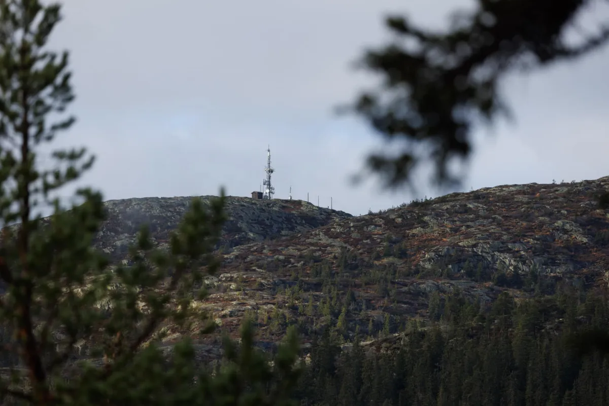
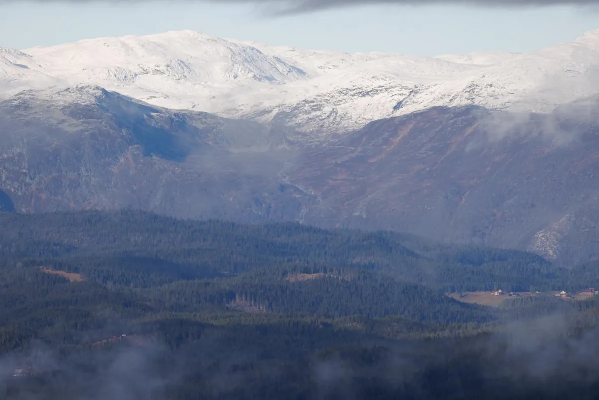
At the bottom of the road before Smørkleppgredi towards Eidsborg, you will see a wooden sign with an arrow up to Eirefjell. This marking will lead you to a long road up to the summit via Jamsmyr, Gygreløftet (the rock), Geiteryggdalane and Flæe. You will first enter a wet bog terrain. There are also a lot of rocks and stones here. The beautiful mountain lakes and ponds are a sight to behold. The path goes past Fjellstaulen and down again. Then over by Svarttjønn before climbing up to the top of Eirefjell (1023 m). At the top you can see far and wide. Everything from the big mountains at Haukeli, Gaustatoppen and surrounding mountain ranges. The total length is 10.1 km and has an elevation gain of about 500 meters. When you have so many friends in Høydalsmo, you have to find out how they like it in their area. It looks like they're doing pretty well. Autumn is a fantastic time for hiking.
At the bottom of the road before Smørkleppgredi towards Eidsborg, you will see a wooden sign with an arrow up to Eirefjell. This marking will lead you to a long road up to the summit via Jamsmyr, Gygreløftet (the rock), Geiteryggdalane and Flæe. You will first enter a wet bog terrain. There are also a lot of rocks and stones here. The beautiful mountain lakes and ponds are a sight to behold. The path goes past Fjellstaulen and down again. Then over by Svarttjønn before climbing up to the top of Eirefjell (1023 m). At the top you can see far and wide. Everything from the big mountains at Haukeli, Gaustatoppen and surrounding mountain ranges. The total length is 10.1 km and has an elevation gain of about 500 meters. When you have so many friends in Høydalsmo, you have to find out how they like it in their area. It looks like they're doing pretty well. Autumn is a fantastic time for hiking.
Photos (8)
1 / 8


Practical info
- Direction
- tur-retur
- Season
- Summer
- Trail quality
- 3/5
- Solitude
- 6/5
Got any good trail tips?
Tokke
Telemark
fintur.no
Telemark
fintur.no