Gøysen
 T
T
Fee
The road or car park has a fee. Bring small change. Some take cards and Vipps.
Weather forecast
Hentar vêrdata…
Kjelde: Yr.no (Meteorologisk institutt)
Map and route
S Start
M Finish
▲ Highest point
▼ Lowest point
km Main route
km Alternativ rute
↕ m Elevation
About this hike
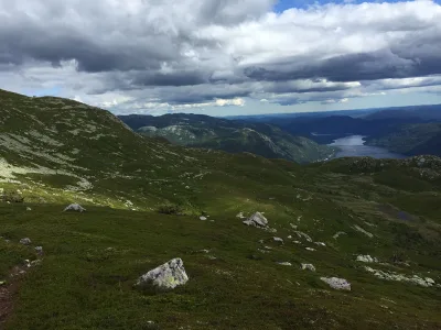
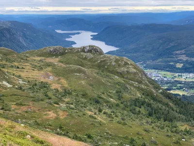
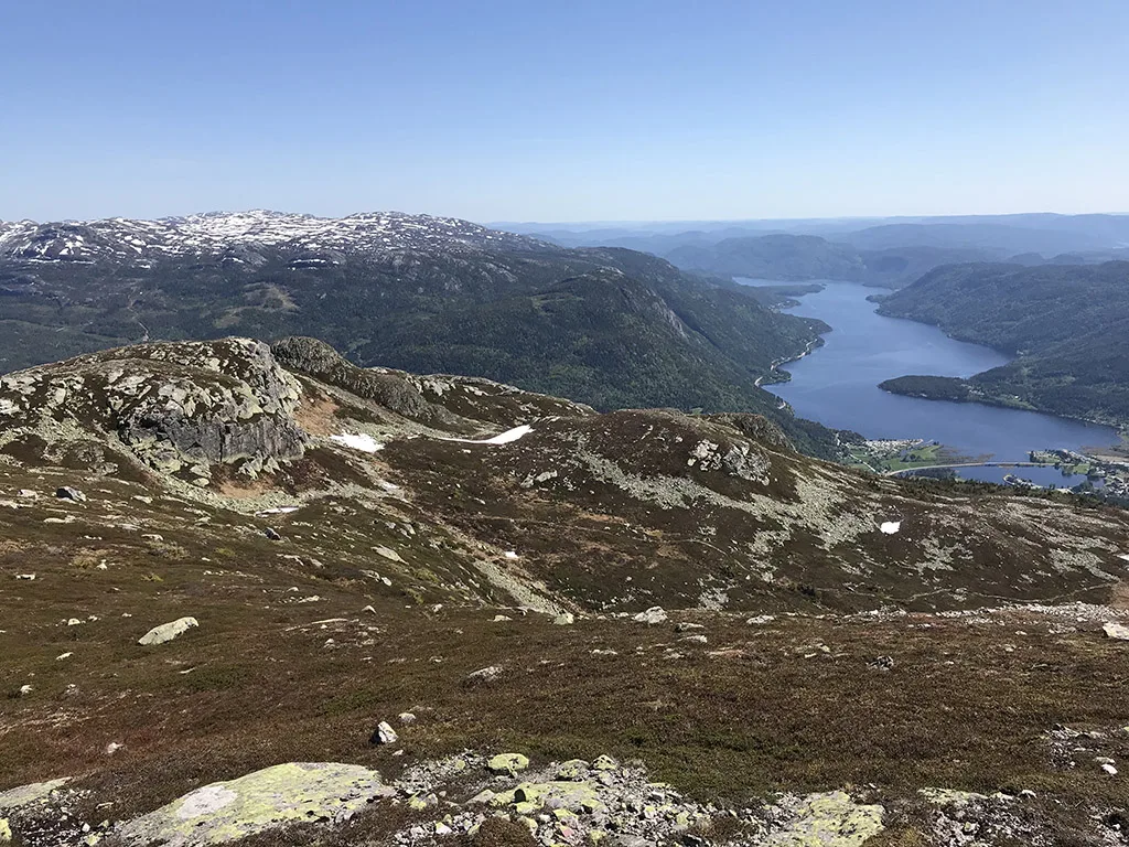
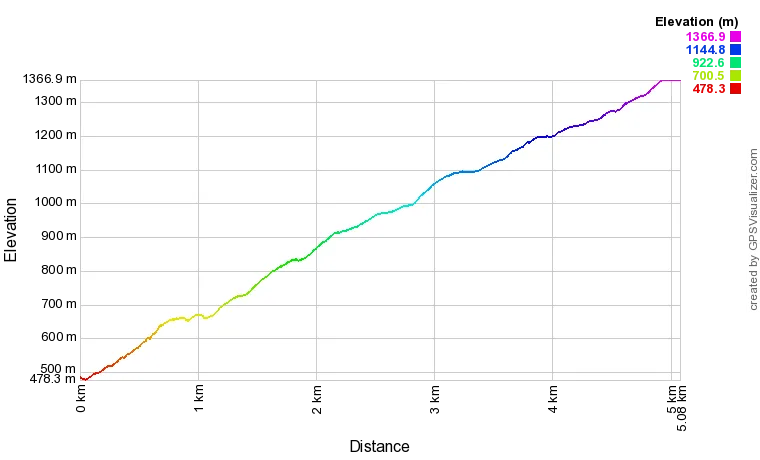
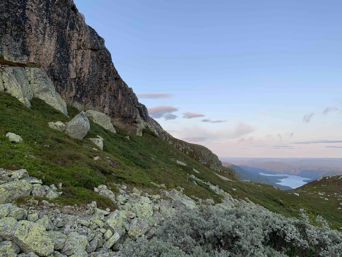
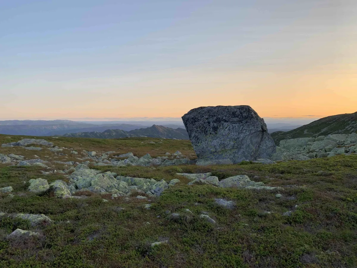
Skorvetoppen, or Gøysen as it is also known locally, towers high above Seljord and is one of the most striking mountains in West Telemark. At 1370 meters above sea level, it stretches up from the deep valleys and provides a wide and magnificent view of both Seljordsvatnet, Gaustatoppen and the endless mountain ranges that characterize this landscape. On a good day, you can see all the way to Hardangervidda in the west and Jotunheimen in the north.
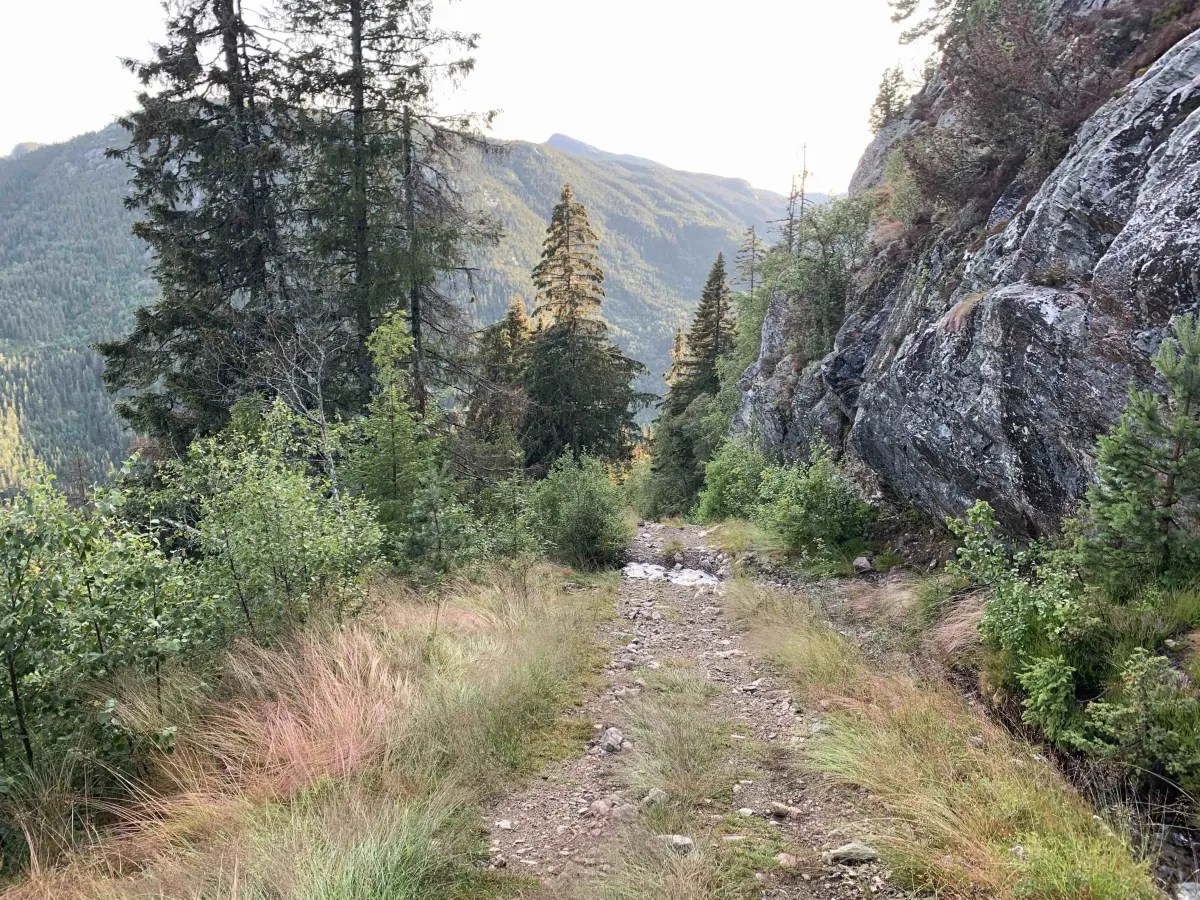
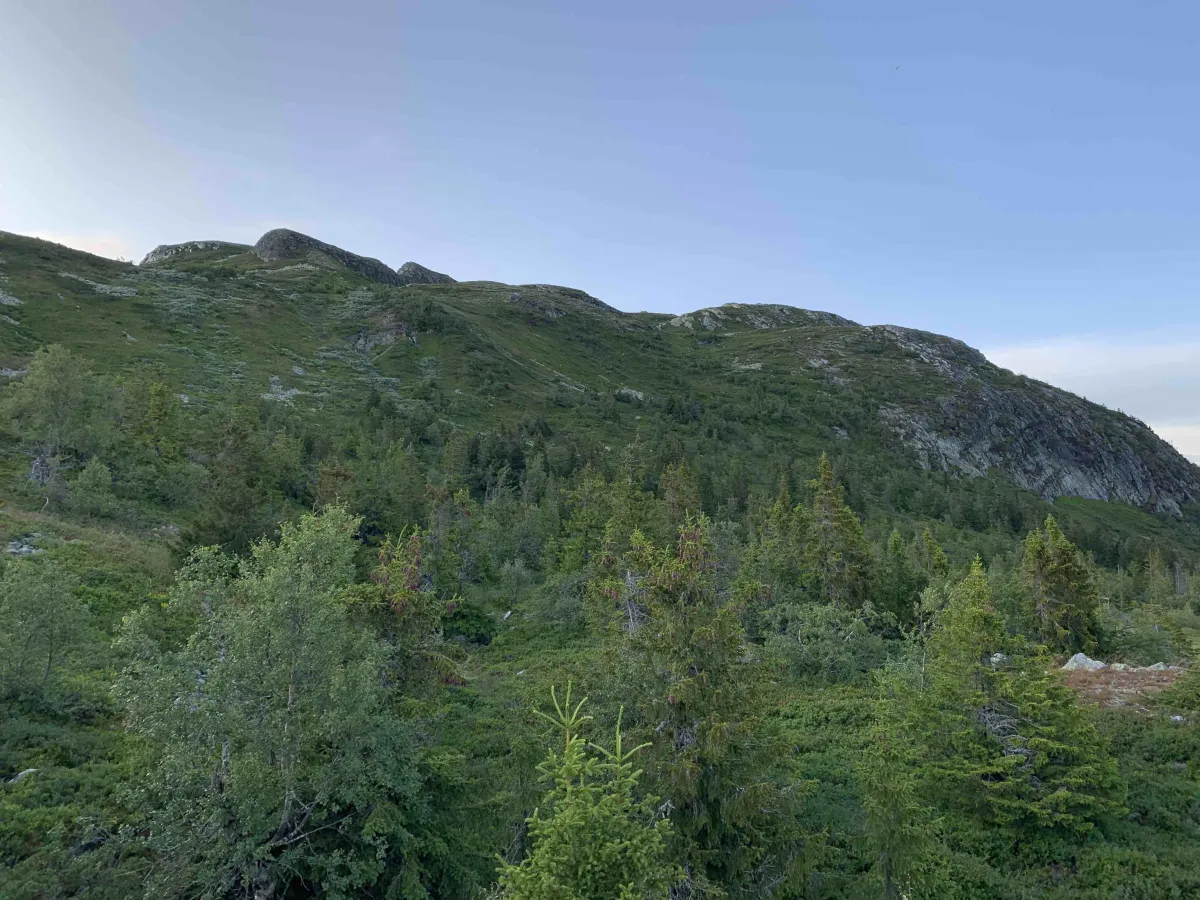
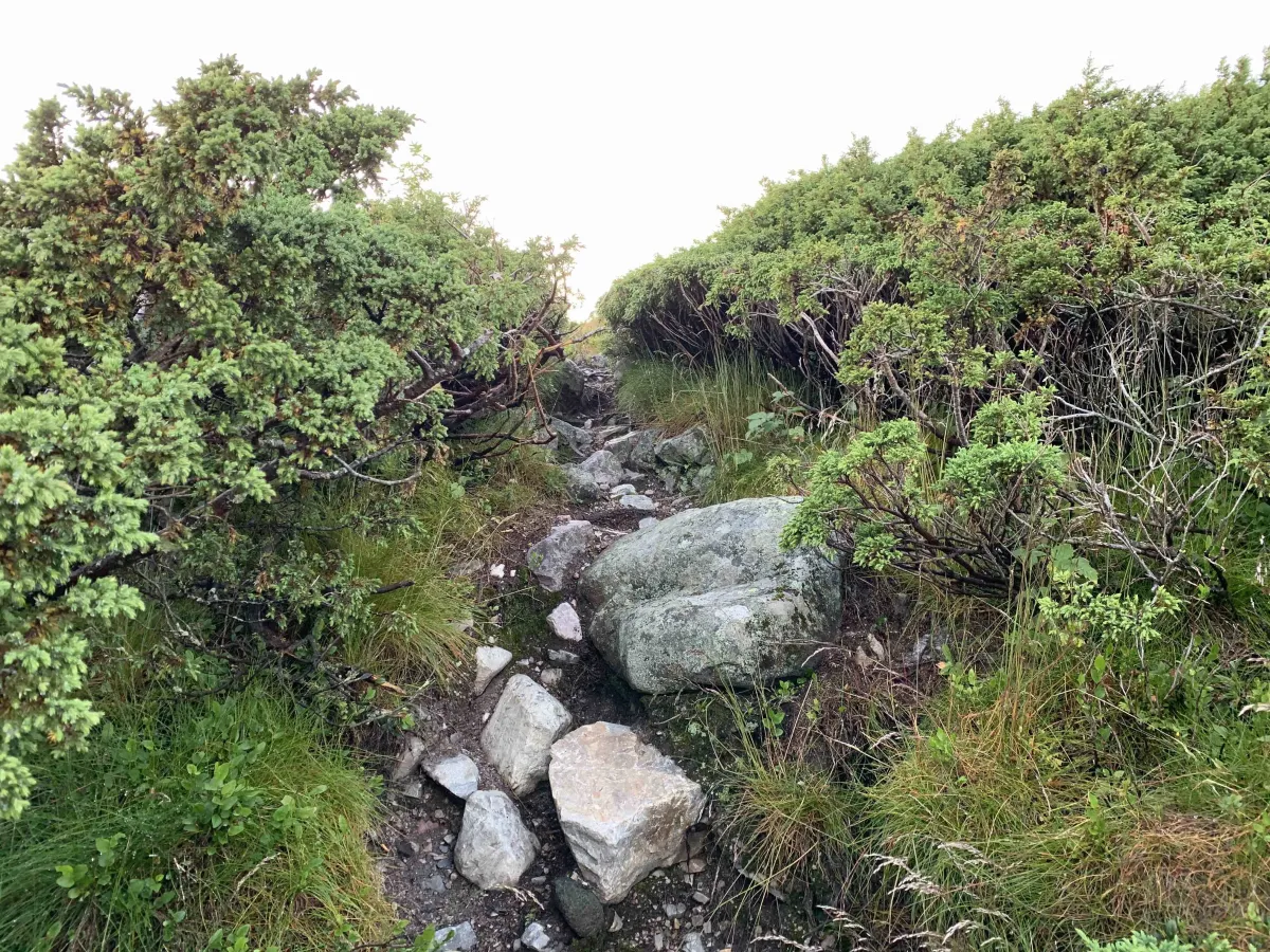
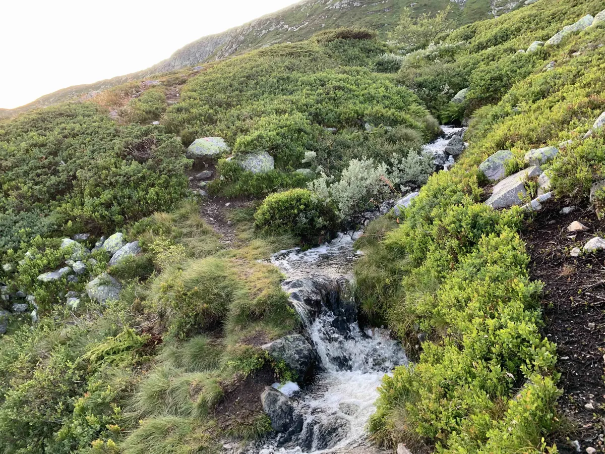
The hike to Skorvetoppen offers both challenge and reward. Most people start from the parking lot at Haugan, where you pay a small amount with Vipps to stand. The trail starts in a dense spruce forest and climbs steeply - there's no easy start here. As you get higher, the landscape opens up. The forest gives way to open moorland and low scrub, and eventually you reach the bare mountain terrain that leads to the summit. The trail is well marked, but the terrain requires good shoes and some stamina.
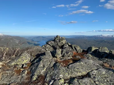
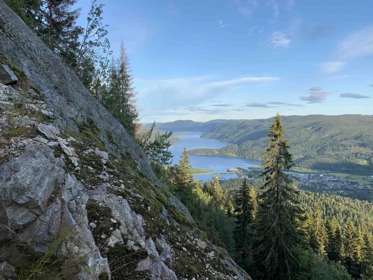
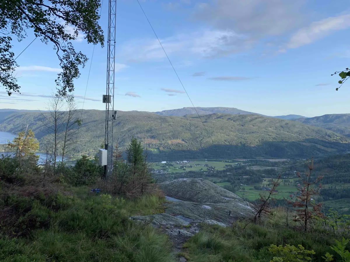
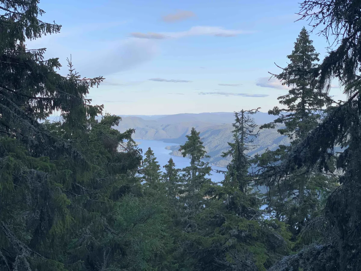
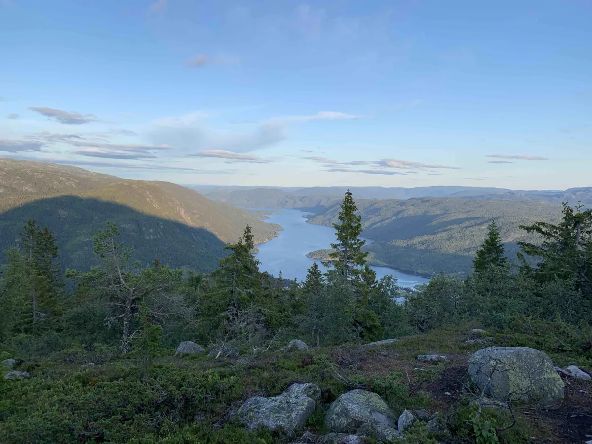
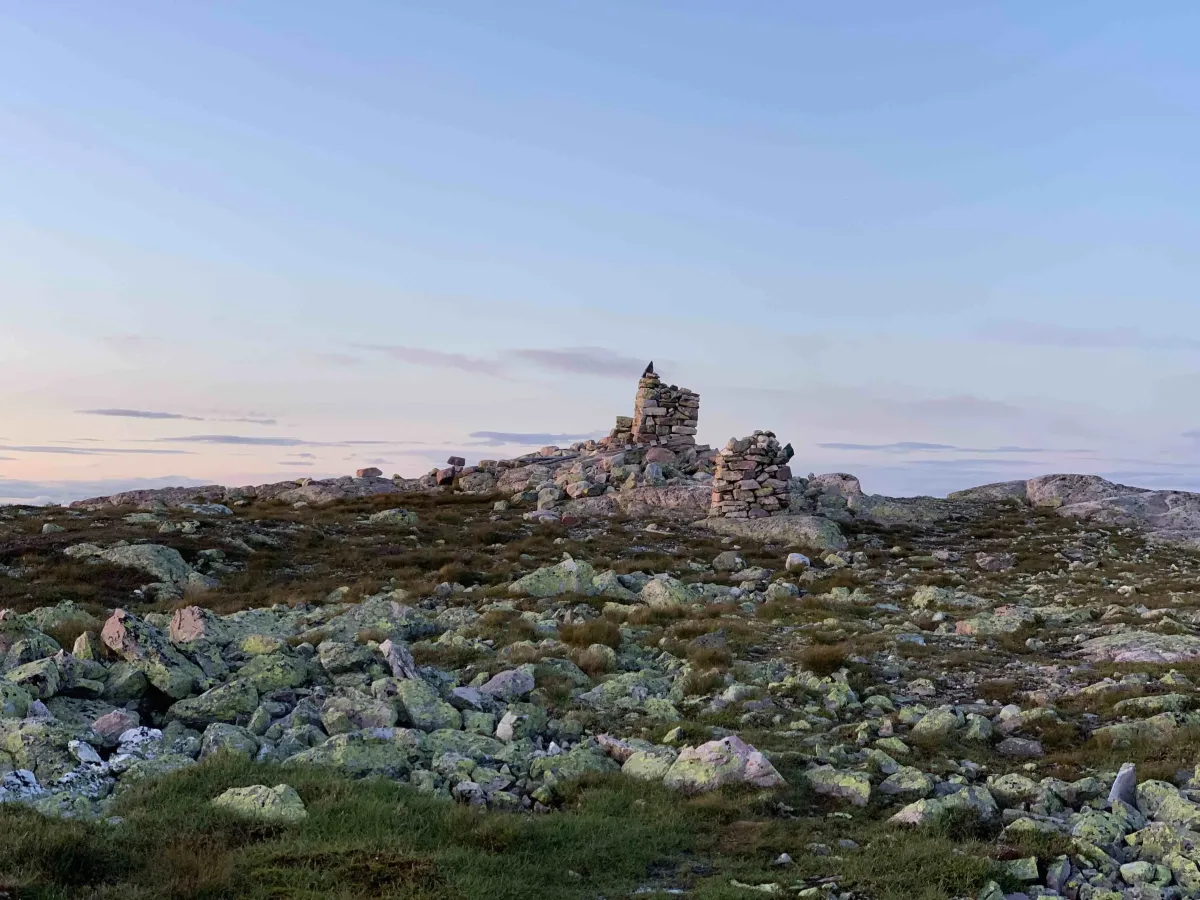
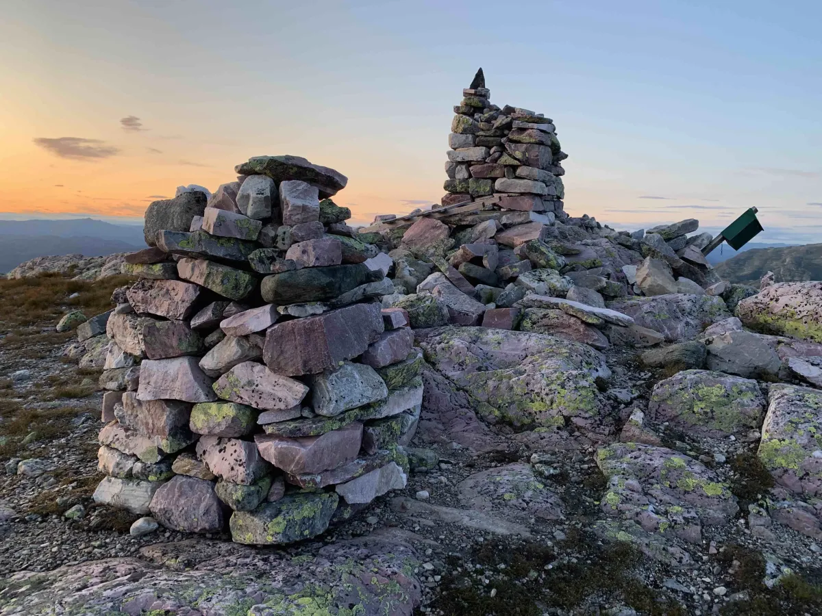
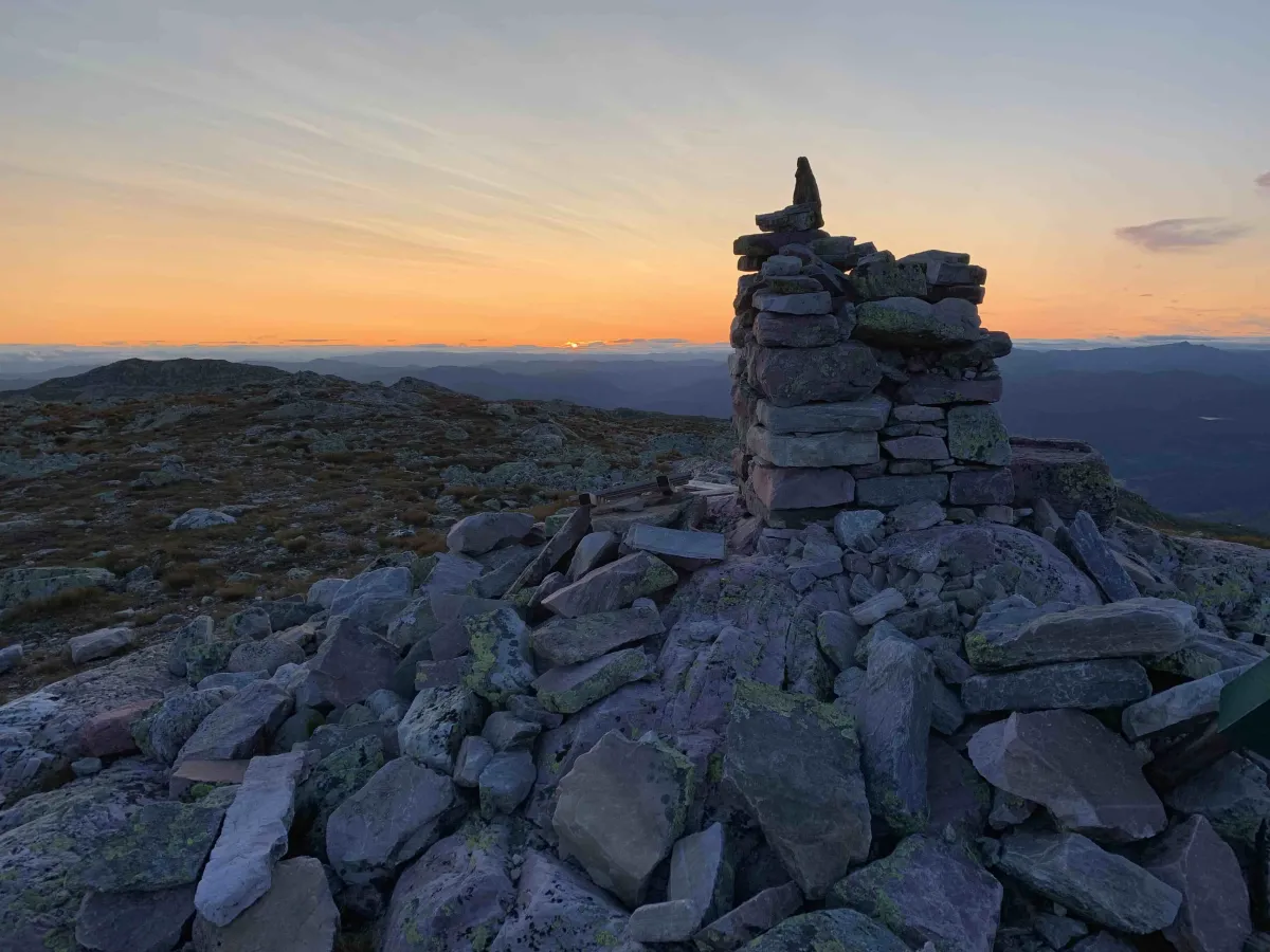
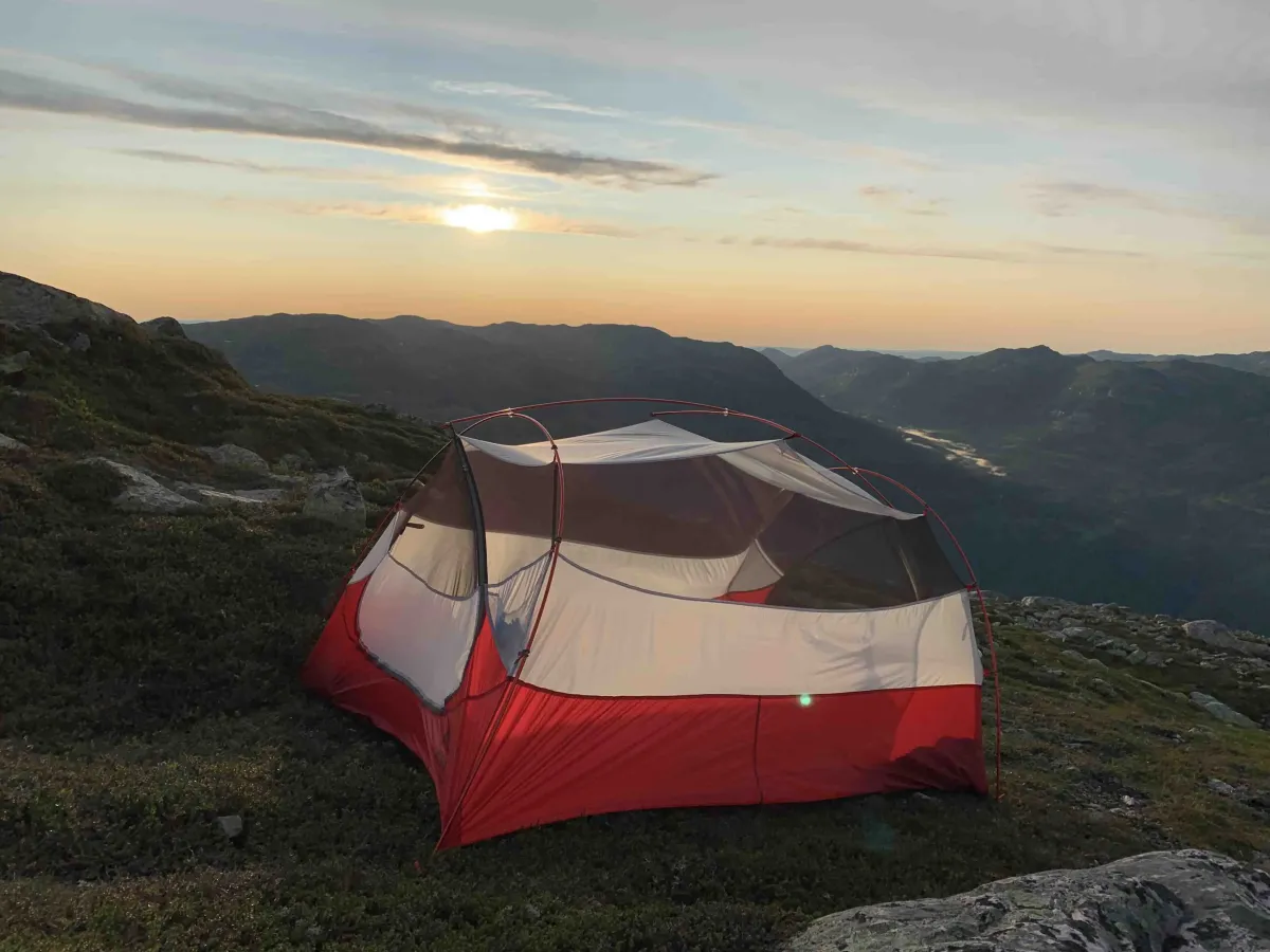
On the way up, you'll pass several viewpoints, but nothing compares to the panoramic view from the summit itself. All around you, you can see Seljordsvatnet lake reflecting in the valley below, and on the horizon, both Mælefjell and Gaustatoppen rise from the landscape like silent giants. Up here, above the tree line and far from the sounds of everyday life, you can feel small and free at the same time.
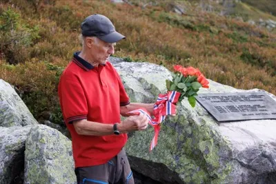
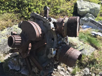
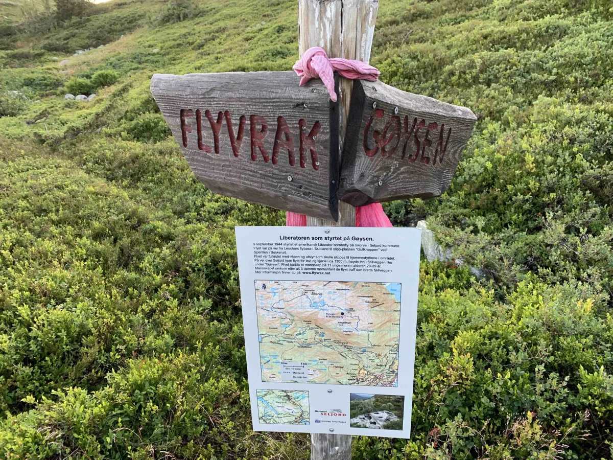
For those who want to extend the hike, it is common to add the route to Nordnibba - a secondary peak of 1364 meters - which is located just north of the main peak. Some also go on to Hestenutan, where you can find traces of plane wrecks from the Second World War. This gives the hike an extra historical dimension and reminds us that our mountains have held both peace and drama.
Skorvetoppen is more than just a hiking destination. It is part of the identity of Seljord and West Telemark. It's the mountain that towers over the village, that attracts hikers from near and far, and that gives a sense of accomplishment to those who make it all the way to the top. To stand up there - in silence, with the wind against your face and the expanse spread out below you - is to feel something real and timeless.
The hike to Skorvetoppen is suitable for those who are used to hiking and want an experience that combines physical effort with magnificent scenery. It's a trip that stays with you the next day - and in your memory for a long time to come.
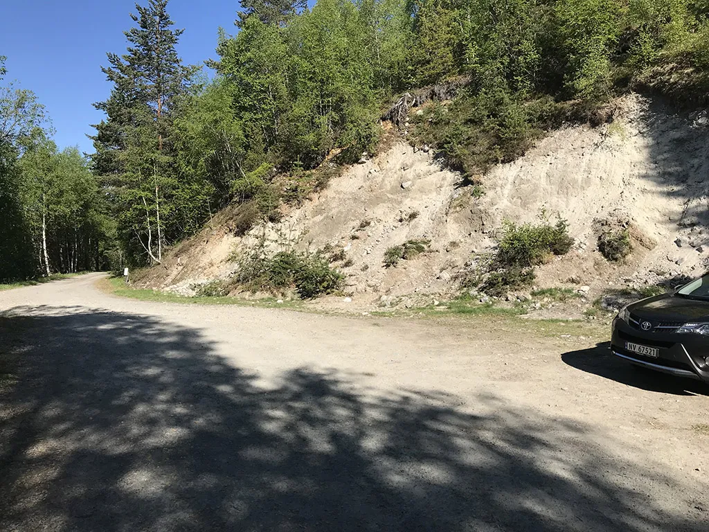
The hike up to Gøysen is perhaps one of the most famous in Seljord. There are several ways up, but if you start from the parking lot at Haugan in Kivledalen, it's easy to find your way. The parking is decent and costs 20 kroner.
From the parking lot you walk a good distance on a tractor road. A few hundred meters up, you can take a shortcut up the path. Then comes the steep part - a tractor road with pebbles. It's not much fun, but you just have to get up.
Then the view opens up over Åsheimgrendi and Seljordsvatnet. You come up to the old "hang glider ramp". It's worth taking a look - and a little break for a drink.
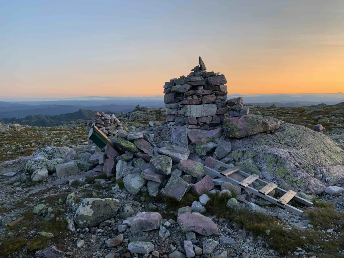
Then follow the tractor road for another 3-400 meters. From there you can take the ladder up to Karlstaul, or you can continue on the road. Then you come up to Listaul, at the tree line. A few hundred meters up the ladder you will come to a junction: One path goes to the American airplane wreck, the other goes straight up to Gøysen. It's further up to the top than it looks - it's easy to be fooled and feel a little discouraged. But hang in there - suddenly you're there!
The hike to Skorvetoppen offers both challenge and reward. Most people start from the parking lot at Haugan, where you pay a small amount with Vipps to stand. The trail starts in a dense spruce forest and climbs steeply - there's no easy start here. As you get higher, the landscape opens up. The forest gives way to open moorland and low scrub, and eventually you reach the bare mountain terrain that leads to the summit. The trail is well marked, but the terrain requires good shoes and some stamina.
On the way up, you'll pass several viewpoints, but nothing compares to the panoramic view from the summit itself. All around you, you can see Seljordsvatnet lake reflecting in the valley below, and on the horizon, both Mælefjell and Gaustatoppen rise from the landscape like silent giants. Up here, above the tree line and far from the sounds of everyday life, you can feel small and free at the same time.
For those who want to extend the hike, it is common to add the route to Nordnibba - a secondary peak of 1364 meters - which is located just north of the main peak. Some also go on to Hestenutan, where you can find traces of plane wrecks from the Second World War. This gives the hike an extra historical dimension and reminds us that our mountains have held both peace and drama.
Skorvetoppen is more than just a hiking destination. It is part of the identity of Seljord and West Telemark. It's the mountain that towers over the village, that attracts hikers from near and far, and that gives a sense of accomplishment to those who make it all the way to the top. To stand up there - in silence, with the wind against your face and the expanse spread out below you - is to feel something real and timeless.
The hike to Skorvetoppen is suitable for those who are used to hiking and want an experience that combines physical effort with magnificent scenery. It's a trip that stays with you the next day - and in your memory for a long time to come.
The hike up to Gøysen is perhaps one of the most famous in Seljord. There are several ways up, but if you start from the parking lot at Haugan in Kivledalen, it's easy to find your way. The parking is decent and costs 20 kroner.
From the parking lot you walk a good distance on a tractor road. A few hundred meters up, you can take a shortcut up the path. Then comes the steep part - a tractor road with pebbles. It's not much fun, but you just have to get up.
Then the view opens up over Åsheimgrendi and Seljordsvatnet. You come up to the old "hang glider ramp". It's worth taking a look - and a little break for a drink.
Then follow the tractor road for another 3-400 meters. From there you can take the ladder up to Karlstaul, or you can continue on the road. Then you come up to Listaul, at the tree line. A few hundred meters up the ladder you will come to a junction: One path goes to the American airplane wreck, the other goes straight up to Gøysen. It's further up to the top than it looks - it's easy to be fooled and feel a little discouraged. But hang in there - suddenly you're there!
Photos (2)
1 / 2
Videos (2)
Gøysen - turen opp
Gøysen - drone
User photos (18)
1 / 18


Practical info
- Direction
- tur-retur
- Season
- Summer
- Trail quality
- 2/5
- Solitude
- 6/5
Got any good trail tips?
Seljord
Telemark
fintur.no
Telemark
fintur.no