Mælefjell
 T
T
Boom wall
The road has a barrier and you need to get the key to the barrier from the road team.
Weather forecast
Hentar vêrdata…
Kjelde: Yr.no (Meteorologisk institutt)
Map and route
S Start
M Finish
▲ Highest point
▼ Lowest point
km Main route
km Alternativ rute
↕ m Elevation
About this hike
Mælefjell - a rocky outcrop, mountain calm and a view from Seljord's second highest point
Mælefjell (1417 m) is a striking and expansive mountain massif between Seljord and Hjartdal. This is a mountain for those who like challenging terrain, real high mountains and great views. You'll need to be prepared to hike in rocky terrain for up to an hour, but for those who are up for the challenge, you're in for a breezy and magnificent hiking experience.
Hiking route: From Mælestaul via Rustjønnan and Eggen
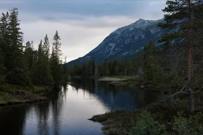
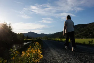
The hike starts from Nedre Mælestaul in the upper part of Seljord. From there you follow a clear path up to Rustjønnan - a beautiful and quiet mountain lake that lies like a pearl in the rocky landscape.
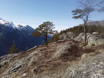
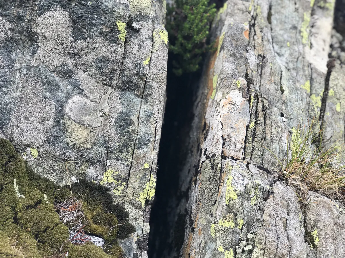
From Rustjønnan you take the path to the edge, and from there you start climbing in rocky terrain. Expect to spend around an hour climbing through rocky cairns and outcrops, where it's important to take your time and wear good footwear.
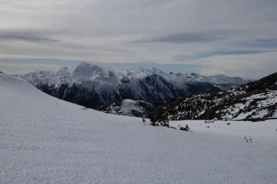
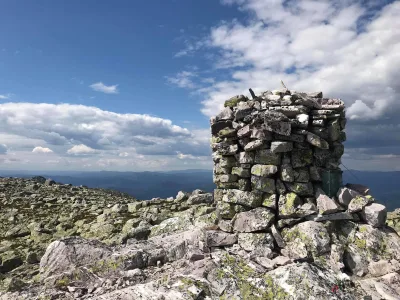
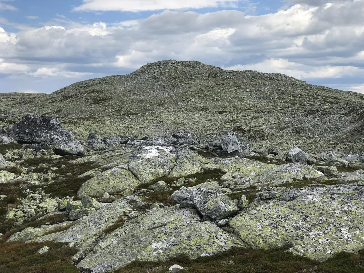
The top of Mælefjell lies at the very back of the mountain massif, near the border with Hjartdal, and is marked by a beautiful cairn. From here you have a wide view in all directions:
- To the west: Steinfjellet and the valley sides down towards Grunningsdalen.
- To the north and east: Londalen in Hjartdal and on towards Blefjell.
- To the south: Lifjell and Skorvefjella.
- On clear days you can see Gaustatoppen in the distance
Alternative routes:
- You can also walk to Mælefjell from the Hjartdal side, but the route from Mælestaul via Rustjønnan is the most used and provides a great experience of the mountain.
Facts about the hike:
- Length: Approx. 10-12 km round trip
- Ascent: Approx. 800 vertical meters
- Level: Demanding - lots of rocks and stones
- Time: 4-6 hours round trip
- Highest point: 1417 m (Seljord's second highest mountain)
Tour tips:
- Wear good hiking boots with support - very rough and demanding terrain
- Avoid the hike in rain or fog - the rocky ridge can be slippery and difficult to navigate
- Bring plenty of water and food - there is little water in the mountains
- Combine the hike with an overnight stay in a tent at Rustjønnan
Mælefjell (1417 m) is a striking and expansive mountain massif between Seljord and Hjartdal. This is a mountain for those who like challenging terrain, real high mountains and great views. You'll need to be prepared to hike in rocky terrain for up to an hour, but for those who are up for the challenge, you're in for a breezy and magnificent hiking experience.
Hiking route: From Mælestaul via Rustjønnan and Eggen
The hike starts from Nedre Mælestaul in the upper part of Seljord. From there you follow a clear path up to Rustjønnan - a beautiful and quiet mountain lake that lies like a pearl in the rocky landscape.
From Rustjønnan you take the path to the edge, and from there you start climbing in rocky terrain. Expect to spend around an hour climbing through rocky cairns and outcrops, where it's important to take your time and wear good footwear.
The top of Mælefjell lies at the very back of the mountain massif, near the border with Hjartdal, and is marked by a beautiful cairn. From here you have a wide view in all directions:
- To the west: Steinfjellet and the valley sides down towards Grunningsdalen.
- To the north and east: Londalen in Hjartdal and on towards Blefjell.
- To the south: Lifjell and Skorvefjella.
- On clear days you can see Gaustatoppen in the distance
Alternative routes:
- You can also walk to Mælefjell from the Hjartdal side, but the route from Mælestaul via Rustjønnan is the most used and provides a great experience of the mountain.
Facts about the hike:
- Length: Approx. 10-12 km round trip
- Ascent: Approx. 800 vertical meters
- Level: Demanding - lots of rocks and stones
- Time: 4-6 hours round trip
- Highest point: 1417 m (Seljord's second highest mountain)
Tour tips:
- Wear good hiking boots with support - very rough and demanding terrain
- Avoid the hike in rain or fog - the rocky ridge can be slippery and difficult to navigate
- Bring plenty of water and food - there is little water in the mountains
- Combine the hike with an overnight stay in a tent at Rustjønnan
Photos (3)

1 / 3
Videos (2)
Mælefjell - turen opp
Mælefjell - toppen
Practical info
- Direction
- tur-retur
- Season
- Summer
- Trail quality
- 1/5
- Solitude
- 6/5
Got any good trail tips?
Flatdal
Telemark
fintur.no
Telemark
fintur.no