Ordalssåta
 T
T
Fee
The road or car park has a fee. Bring small change. Some take cards and Vipps.
Weather forecast
Hentar vêrdata…
Kjelde: Yr.no (Meteorologisk institutt)
Map and route
S Start
M Finish
▲ Highest point
▼ Lowest point
km Main route
↕ m Elevation
About this hike
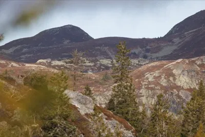
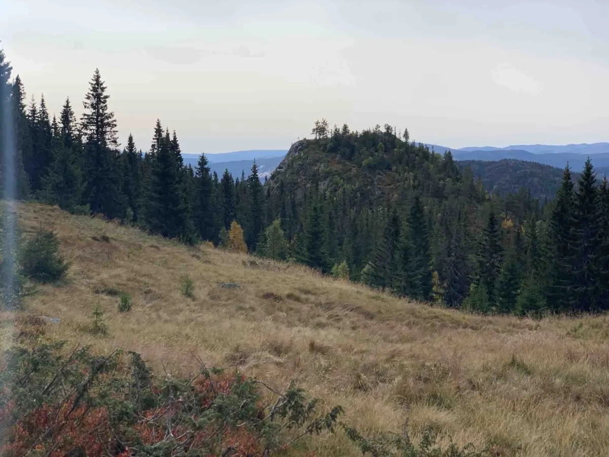
Ordalssåta is a summit that may not be at the top of the hiking books, but which offers views, tranquillity and varied terrain. The hike goes through forests, marshes and mountains, and is suitable for those who like less busy routes and a good challenge on their feet.
Starting point:
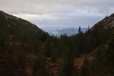
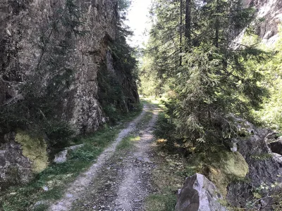
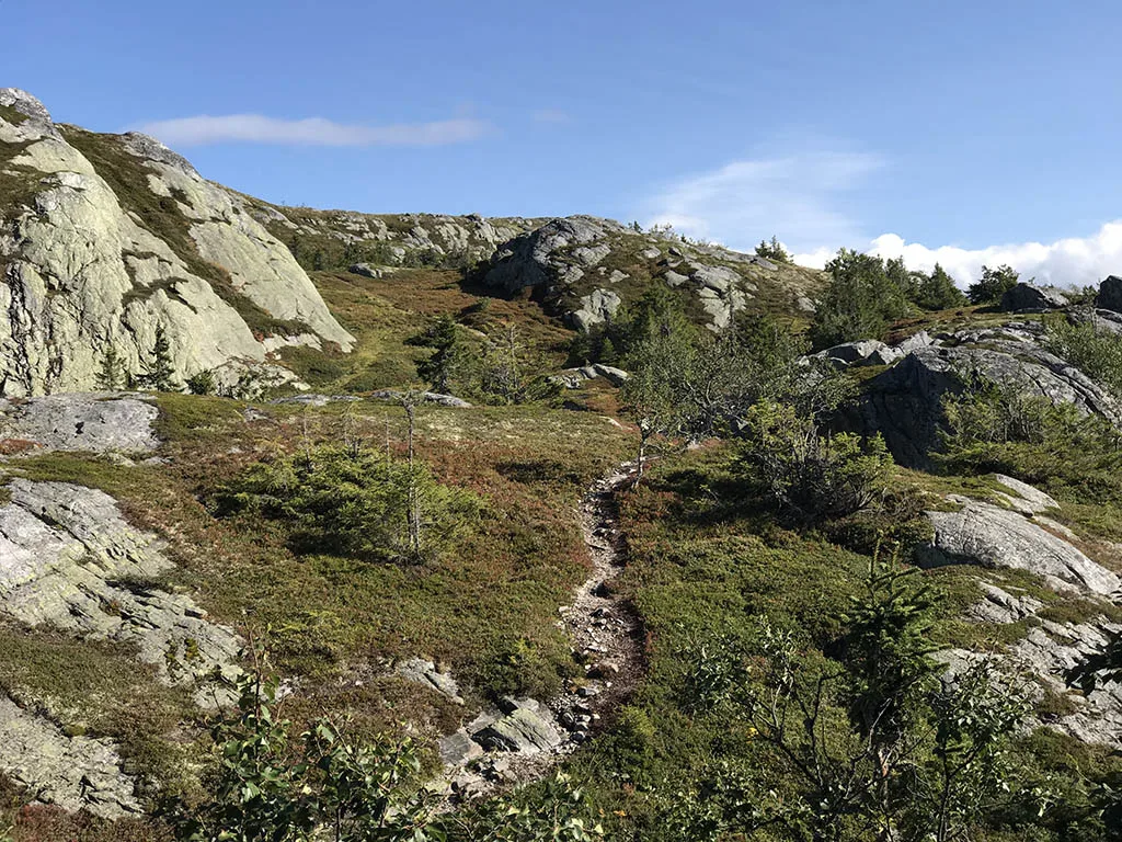
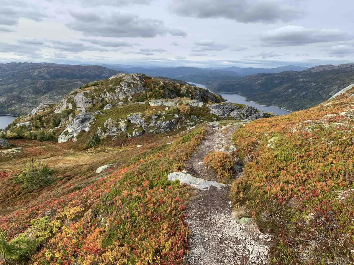
You start the hike up in Ordal, on a toll road where there is easy parking at the end. The tour begins with 1.5 km along a tractor road, which winds steadily uphill in forest terrain. After a quarter of a mile, you turn off the road into more marshy and rugged terrain, where the path becomes narrower and the landscape more open.
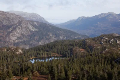
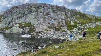
Here you cross bogs and rocks, and although the summit looks fairly close, the hike is longer than it seems - you have to expect about 4 km up and the same down again.
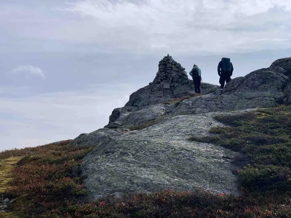
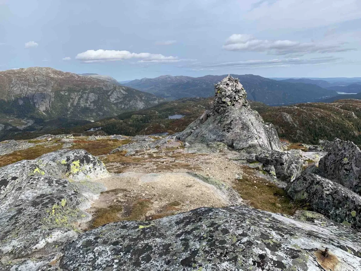
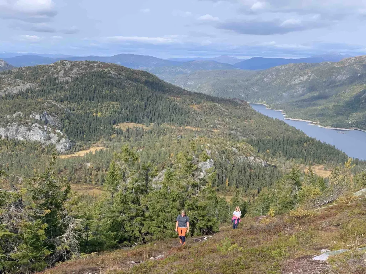
At the top of Ordalssåta:
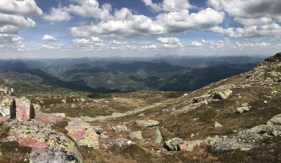
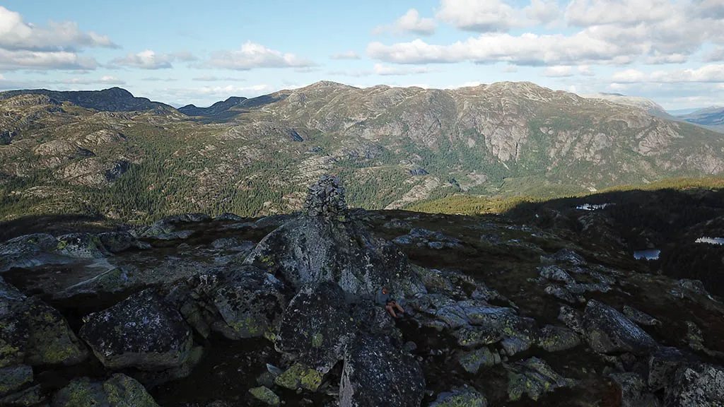
The summit is airy and offers great views of parts of the mountain areas around Ordal and further towards Skorve and Åmotsdalsheiane. It's rarely crowded here, and you have a good chance of having the whole mountain to yourself - a perfect hiking destination for those who want a quiet moment in nature.
Facts about the hike:
- Length: Approx. 8 km round trip
- Gradient: Moderate, but with a steeper section in the last half.
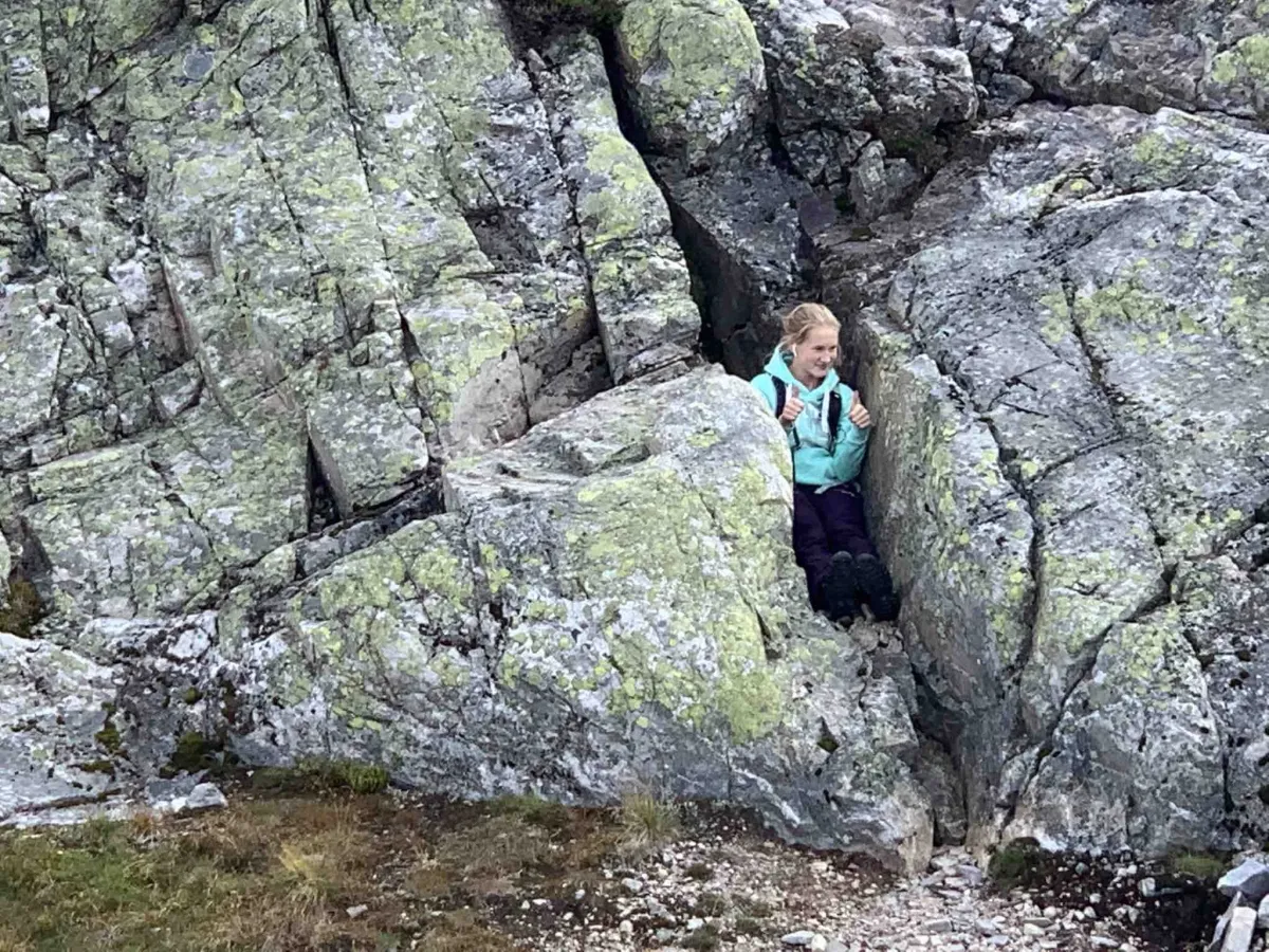
- Level: Intermediate - requires some experience in unmarked/boggy terrain
- Time: 3-4 hours in total
- Surface: Tractor road, path, bog and rock
- Marking: Partially marked - feel free to bring a map or GPS
Hiking tips:
- Wear good shoes - bogs and slippery rocks can be challenging.
- The tour is well suited to a leisurely half-day hike or training session
- Can be combined with several small peaks and routes in the Ordal area
- Suitable for those who want to experience a quiet and little-visited mountainside in Seljord
Starting point:
You start the hike up in Ordal, on a toll road where there is easy parking at the end. The tour begins with 1.5 km along a tractor road, which winds steadily uphill in forest terrain. After a quarter of a mile, you turn off the road into more marshy and rugged terrain, where the path becomes narrower and the landscape more open.
Here you cross bogs and rocks, and although the summit looks fairly close, the hike is longer than it seems - you have to expect about 4 km up and the same down again.
At the top of Ordalssåta:
The summit is airy and offers great views of parts of the mountain areas around Ordal and further towards Skorve and Åmotsdalsheiane. It's rarely crowded here, and you have a good chance of having the whole mountain to yourself - a perfect hiking destination for those who want a quiet moment in nature.
Facts about the hike:
- Length: Approx. 8 km round trip
- Gradient: Moderate, but with a steeper section in the last half.
- Level: Intermediate - requires some experience in unmarked/boggy terrain
- Time: 3-4 hours in total
- Surface: Tractor road, path, bog and rock
- Marking: Partially marked - feel free to bring a map or GPS
Hiking tips:
- Wear good shoes - bogs and slippery rocks can be challenging.
- The tour is well suited to a leisurely half-day hike or training session
- Can be combined with several small peaks and routes in the Ordal area
- Suitable for those who want to experience a quiet and little-visited mountainside in Seljord
Photos (1)
Videos (2)
Ordalsåta - turen opp
Ordalsåta - toppen
User photos (6)
1 / 6
Practical info
- Direction
- tur-retur
- Season
- Summer
- Trail quality
- 2/5
- Solitude
- 5/5
Got any good trail tips?
Kviteseid
Telemark
fintur.no
Telemark
fintur.no