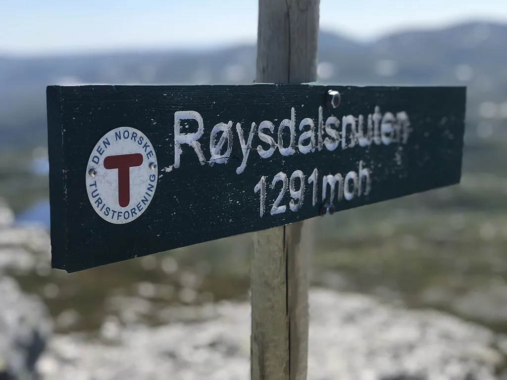
Røysdalsnuten
 T
T
Fee
The road or car park has a fee. Bring small change. Some take cards and Vipps.
Weather forecast
Hentar vêrdata…
Kjelde: Yr.no (Meteorologisk institutt)
Map and route
S Start
M Finish
▲ Highest point
▼ Lowest point
km Main route
km Alternativ rute
↕ m Elevation
About this hike
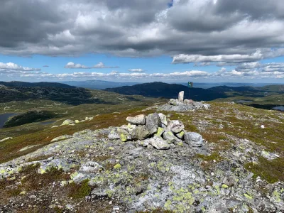
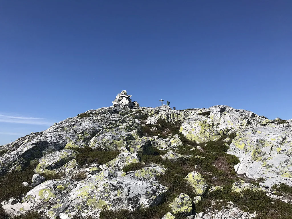
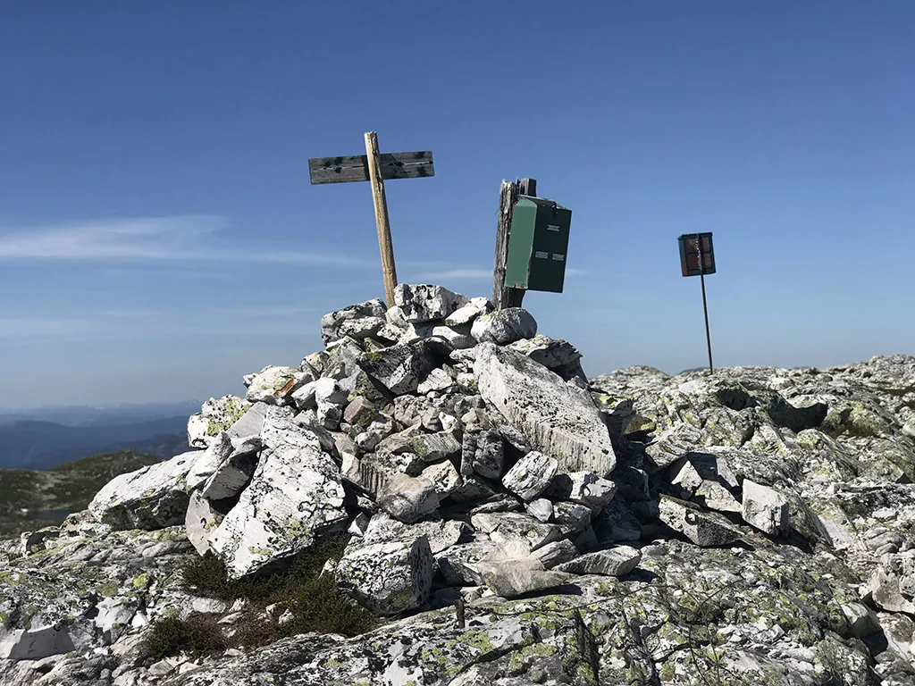
Røysdalsnuten - Lifjell's roof at 1291 m above sea level
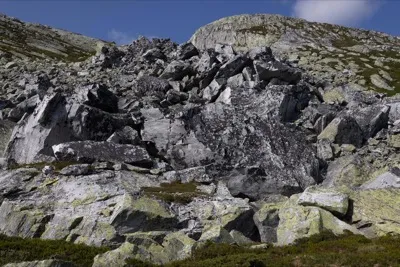
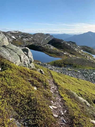
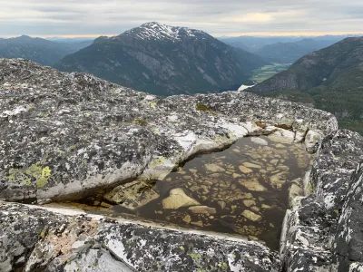
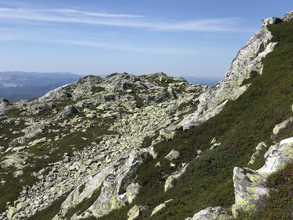
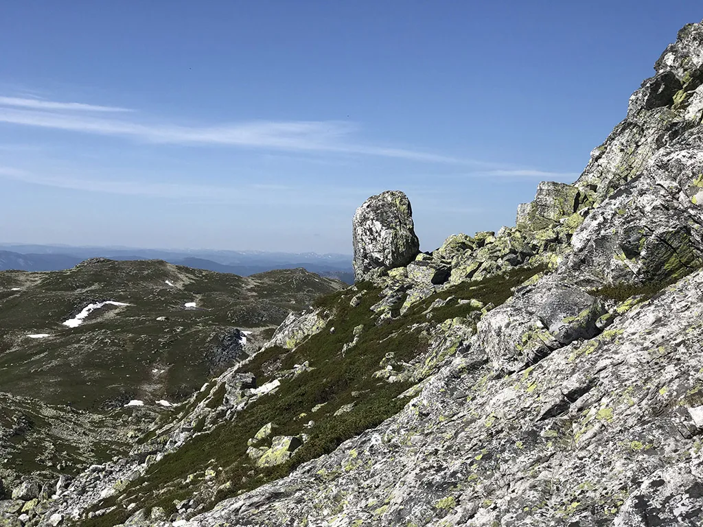
Røysdalsnuten (1291 m) is the highest peak on the Lifjell plateau, and a breezy hiking destination for those who want to stand at the top of this vast high mountain area. As the name suggests, the summit lies in a rocky ridge - which makes the last part of the hike both rough and raw. The view from the top is spectacular in all directions - from Skorve and Seljordsvatnet to Gaustatoppen, Raulandsfjella and the entire Lifjell massif.
Main route from Grimås - via Grimaren and the mountain plateau
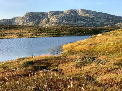
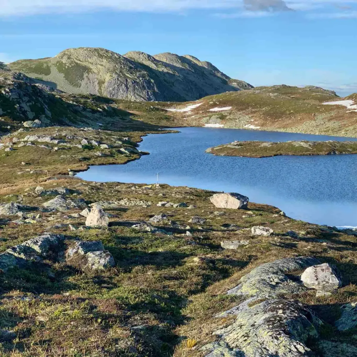
The hike starts from the parking lot at Grimås (toll road in Grunningsdalen). From here you follow the trail up to Grimaren (1169 meters above sea level), an airy and beautiful peak in its own right. After Grimaren, continue into the open mountain area in the direction of Tjorbuvatna, before turning off towards Røysdalsnuten.
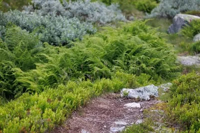
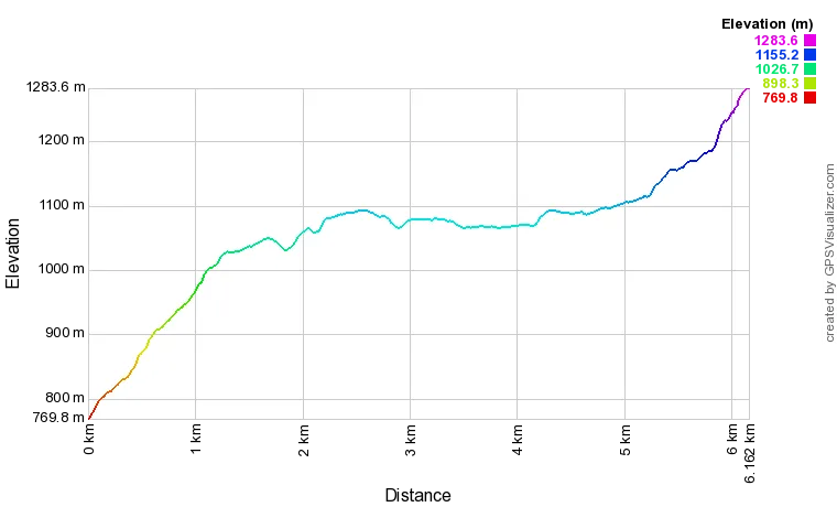
As you approach your destination, the landscape becomes more rocky, and the last part of the hike is rough and tumble - take your time and watch your feet. It's about 6.4 km from start to top, and it's a solid hike with climbs, views and mountain serenity.
Alternative routes:
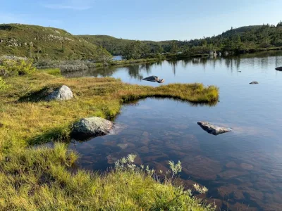
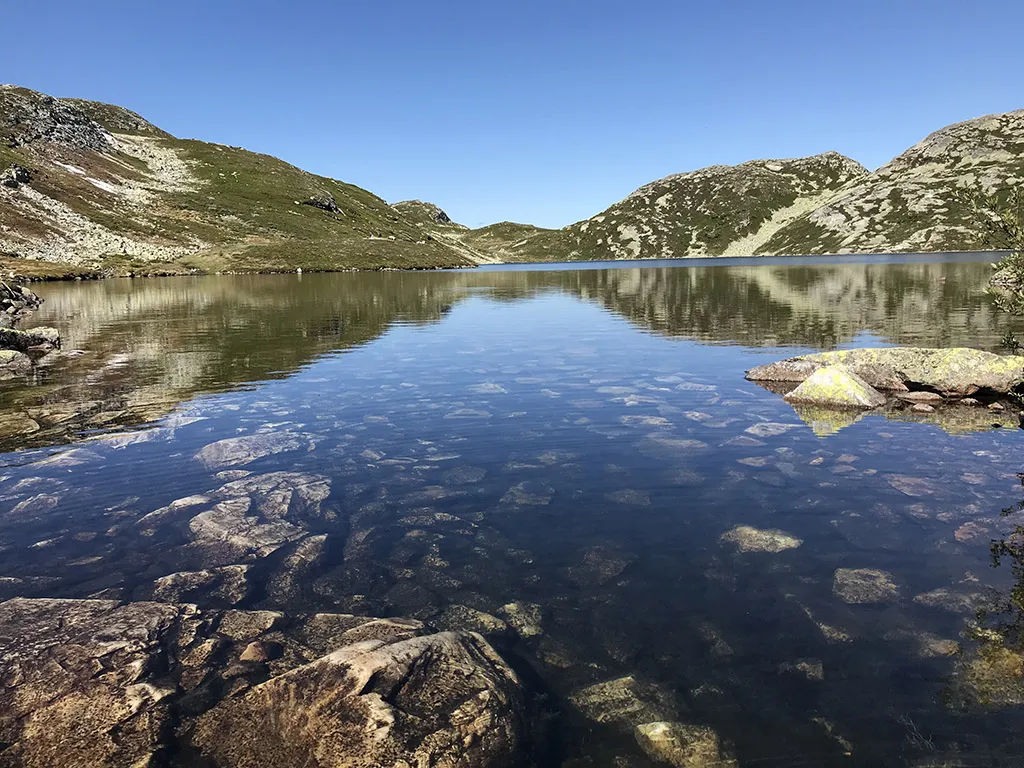
- You can also walk from Hollane, via Tjorbuvatna and towards Nuten.
- A longer variant goes from Røysdalssida or Nordstul in Notodden, for those who want to explore the entire plateau
- Røysdalsnuten is also a natural destination for multi-day hikes across Lifjell
Facts about the hike:
- Length: 6.4 km one way from Grimås
- Highest point: 1291 m (Lifjell's highest)
- Ascent: Approximately 700 vertical meters
- Time: 4-5 hours round trip (more at a leisurely pace or round trip)
- Surface: Paths, mountain terrain, clocks and cairns
- Level: Moderate to demanding - especially the last part in rocks
Hiking tips:
- Wear sturdy hiking boots - the last part is in rocky terrain.
- The hike is well suited to clear weather - it is open and there is little shelter
- Bring a map or GPS - the paths on Lifjell can be confusing
- Combine the hike with a break at Tjorbuvatna or an overnight stay in a tent on the plateau
Røysdalsnuten (1291 m) is the highest peak on the Lifjell plateau, and a breezy hiking destination for those who want to stand at the top of this vast high mountain area. As the name suggests, the summit lies in a rocky ridge - which makes the last part of the hike both rough and raw. The view from the top is spectacular in all directions - from Skorve and Seljordsvatnet to Gaustatoppen, Raulandsfjella and the entire Lifjell massif.
Main route from Grimås - via Grimaren and the mountain plateau
The hike starts from the parking lot at Grimås (toll road in Grunningsdalen). From here you follow the trail up to Grimaren (1169 meters above sea level), an airy and beautiful peak in its own right. After Grimaren, continue into the open mountain area in the direction of Tjorbuvatna, before turning off towards Røysdalsnuten.
As you approach your destination, the landscape becomes more rocky, and the last part of the hike is rough and tumble - take your time and watch your feet. It's about 6.4 km from start to top, and it's a solid hike with climbs, views and mountain serenity.
Alternative routes:
- You can also walk from Hollane, via Tjorbuvatna and towards Nuten.
- A longer variant goes from Røysdalssida or Nordstul in Notodden, for those who want to explore the entire plateau
- Røysdalsnuten is also a natural destination for multi-day hikes across Lifjell
Facts about the hike:
- Length: 6.4 km one way from Grimås
- Highest point: 1291 m (Lifjell's highest)
- Ascent: Approximately 700 vertical meters
- Time: 4-5 hours round trip (more at a leisurely pace or round trip)
- Surface: Paths, mountain terrain, clocks and cairns
- Level: Moderate to demanding - especially the last part in rocks
Hiking tips:
- Wear sturdy hiking boots - the last part is in rocky terrain.
- The hike is well suited to clear weather - it is open and there is little shelter
- Bring a map or GPS - the paths on Lifjell can be confusing
- Combine the hike with a break at Tjorbuvatna or an overnight stay in a tent on the plateau
Photos (6)
1 / 6
Videos (2)
Røysdalsnuten - toppen
Røysdalsnuten - turen opp
User photos (1)
Practical info
- Direction
- tur-retur
- Season
- Summer
- Trail quality
- 3/5
- Solitude
- 6/5
Got any good trail tips?
Seljord
Telemark
fintur.no
Telemark
fintur.no