Såta
Boom wall
The road has a barrier and you need to get the key to the barrier from the road team.
Weather forecast
Hentar vêrdata…
Kjelde: Yr.no (Meteorologisk institutt)
Map and route
S Start
M Finish
▲ Highest point
▼ Lowest point
km Main route
km Alternativ rute
↕ m Elevation
About this hike
Såta (1154 m) is one of the most visible caves in Seljord - clearly visible from Brøløs, and an impressive hiking destination for those who want to go up and far. This hike is part of a long hike over the Mælefjell massif, with several caves, cabins and views along the way.
The starting point is at the shooting range in Aarhus, where you follow a steep tractor road upwards - with 200 meters of ascent per kilometer the first part. The first stop is Århusnuten, with great views of the valley, the industrial area, Lifjell and Skorve.
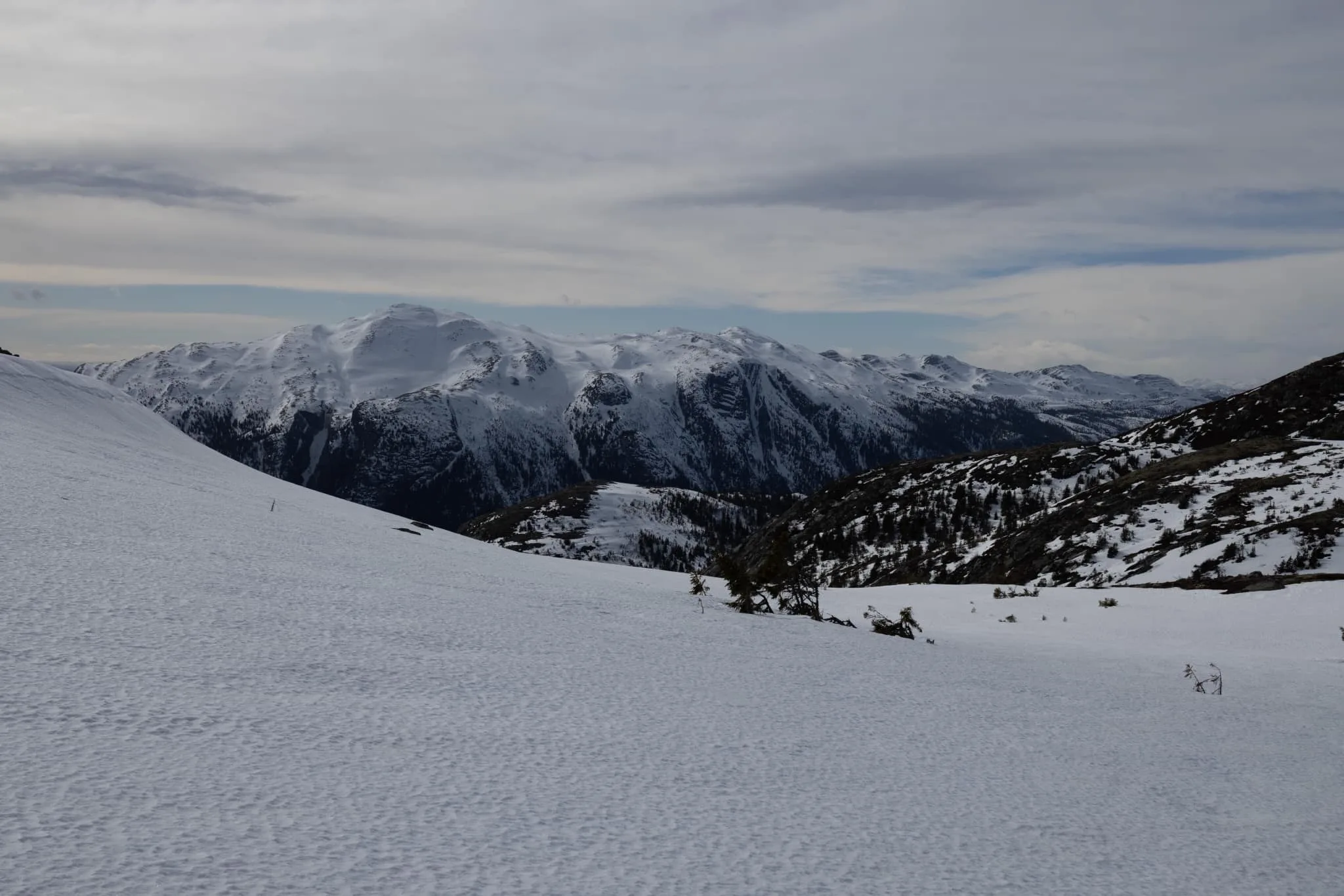
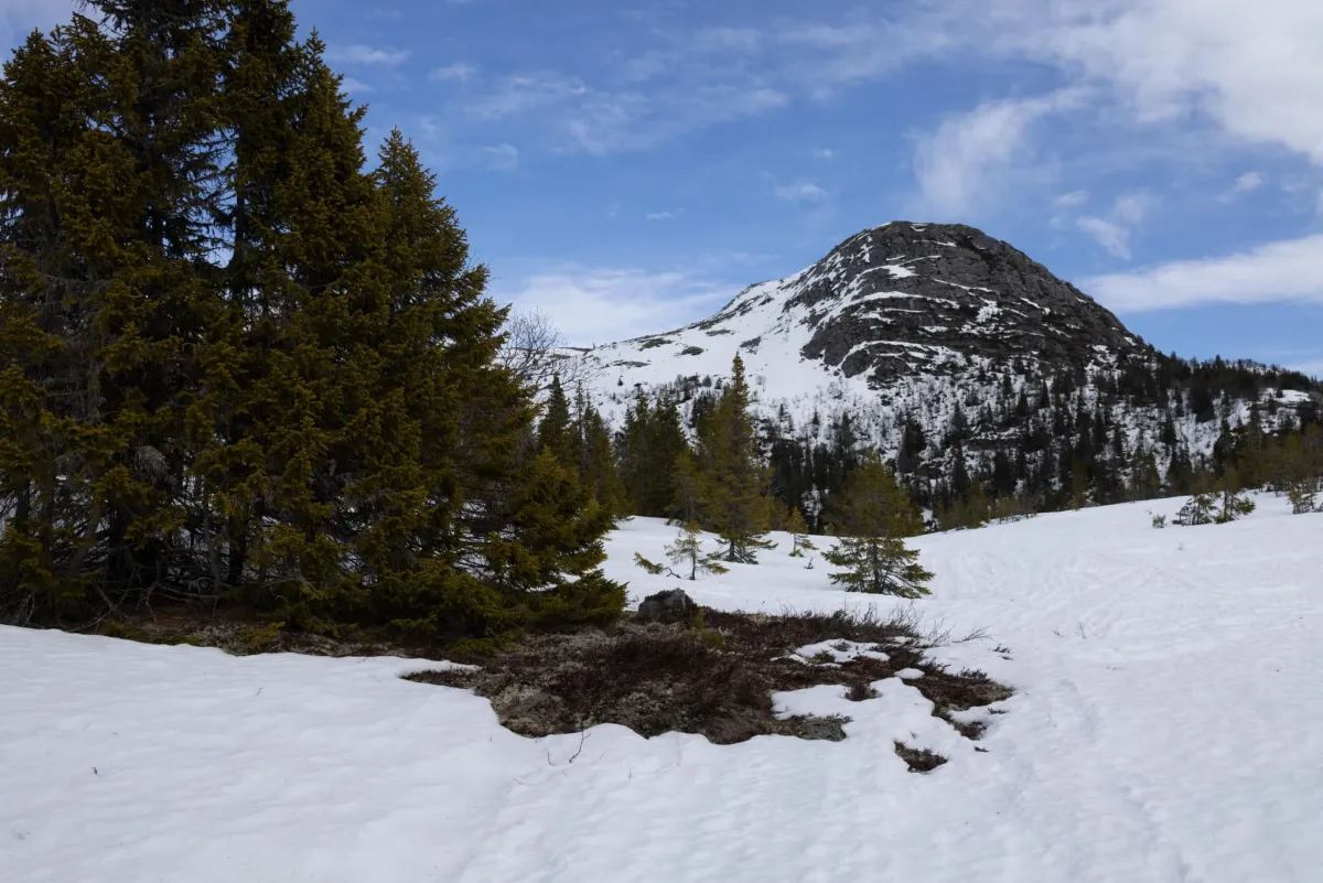
The trail continues up towards Strandfjellet, where you get a magnificent view of the Skorve side - a good campsite for summer use. The trail continues up towards the striking Såta, one of the most characteristic peaks in the area.
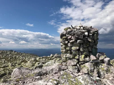
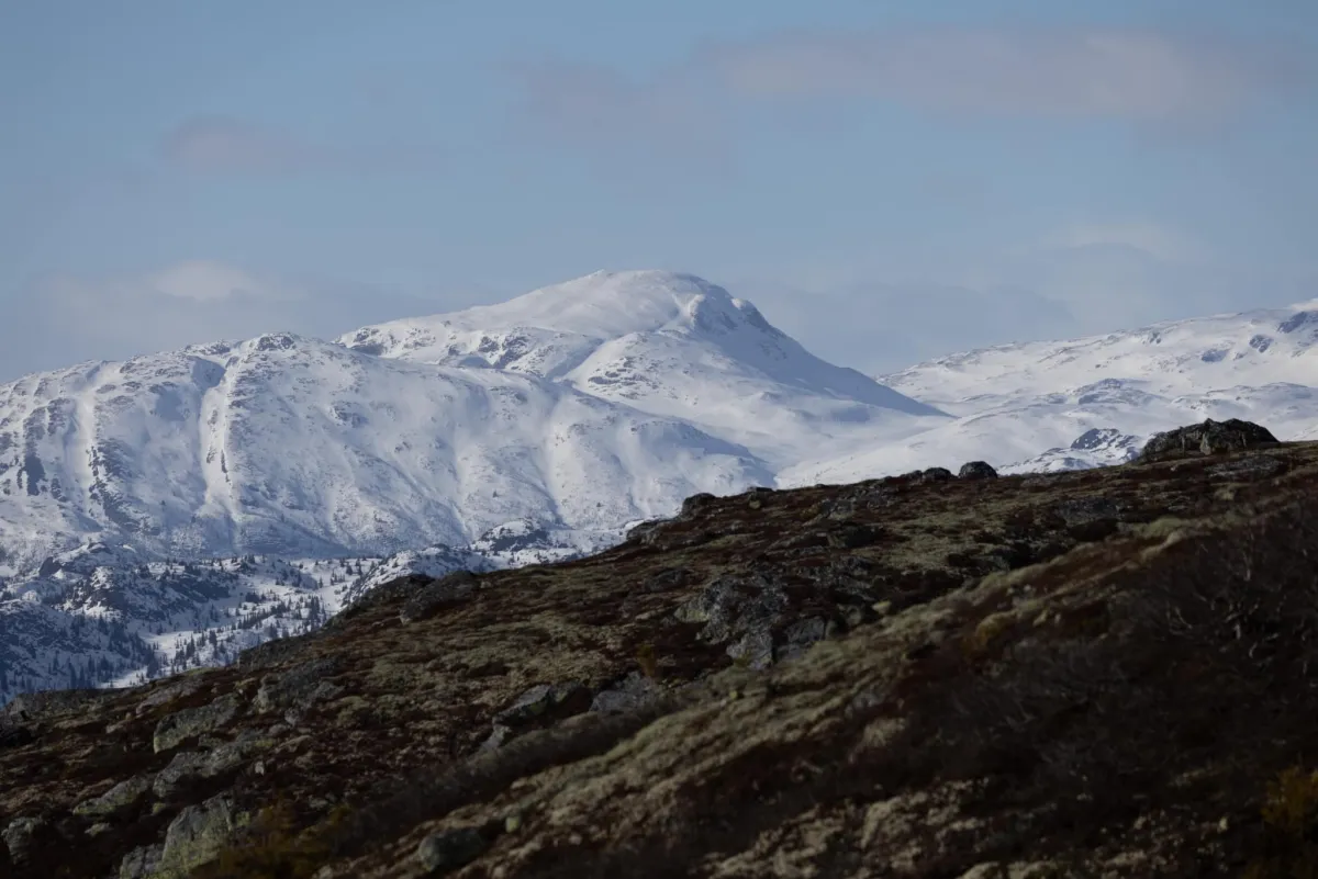
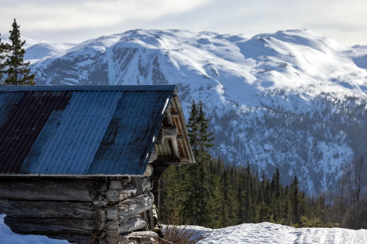
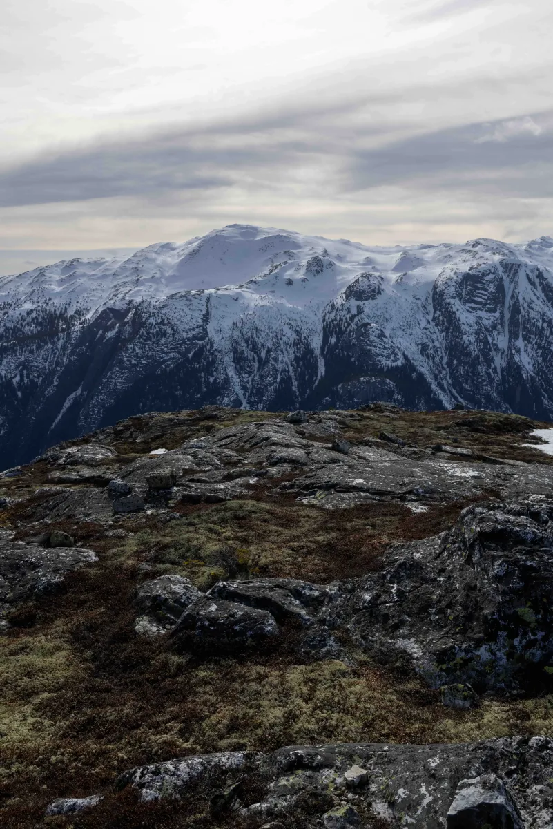
Along the way, you'll pass Doktorhytta - located roughly in the middle of the Mælefjelltunnel - a natural place to take a break. At the top of Såta, 1154 meters above sea level, you get spectacular views in all directions, with Gaustatoppen, Vindeggen, Brattefjell, Hestenutane, Nornibba and all of Skorveryggen silhouetted against the sky.
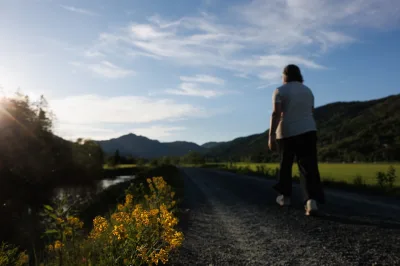
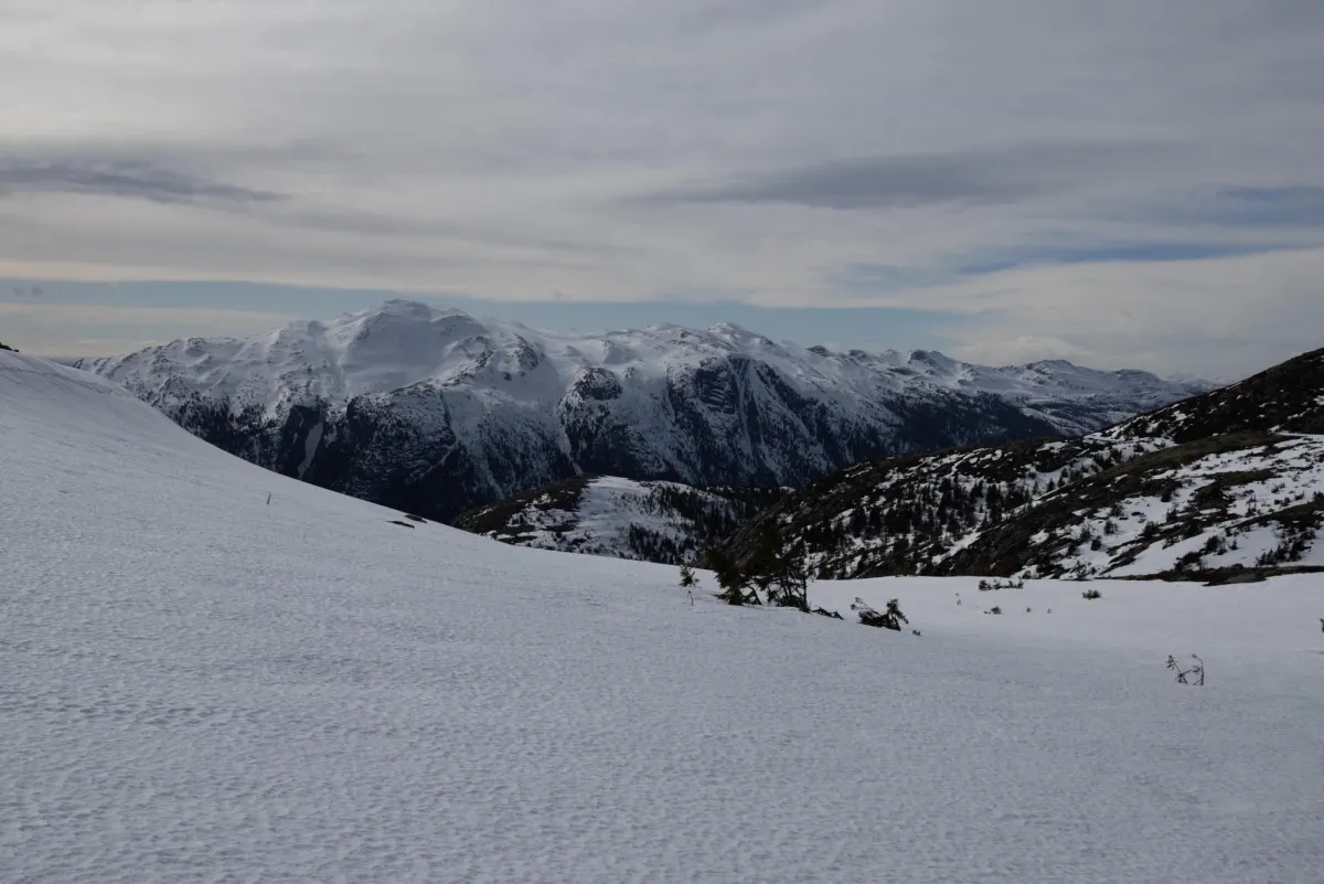
The hike can be continued towards Langtjønnane and the groove at 1282 meters above sea level, before descending via Rustjønnane and the mountains towards the village. The length, vertical meters and terrain require plenty of time and good physical fitness - but the rewards are great.
Length: 21 km (long walk)
Time: 5.5 hours + breaks
Altitude: 1154 m above sea level (Såta), 1282 m above sea level (Langtjønnnuten)
Ascent: Over 1500 vertical meters
Terrain: Steep tractor road, high mountains, narrow mountains, nutar
Difficulty level: Demanding
Suitable for: Long day trips, spring ski touring, summer expeditions, mountaineering enthusiasts.
The starting point is at the shooting range in Aarhus, where you follow a steep tractor road upwards - with 200 meters of ascent per kilometer the first part. The first stop is Århusnuten, with great views of the valley, the industrial area, Lifjell and Skorve.
The trail continues up towards Strandfjellet, where you get a magnificent view of the Skorve side - a good campsite for summer use. The trail continues up towards the striking Såta, one of the most characteristic peaks in the area.
Along the way, you'll pass Doktorhytta - located roughly in the middle of the Mælefjelltunnel - a natural place to take a break. At the top of Såta, 1154 meters above sea level, you get spectacular views in all directions, with Gaustatoppen, Vindeggen, Brattefjell, Hestenutane, Nornibba and all of Skorveryggen silhouetted against the sky.
The hike can be continued towards Langtjønnane and the groove at 1282 meters above sea level, before descending via Rustjønnane and the mountains towards the village. The length, vertical meters and terrain require plenty of time and good physical fitness - but the rewards are great.
Length: 21 km (long walk)
Time: 5.5 hours + breaks
Altitude: 1154 m above sea level (Såta), 1282 m above sea level (Langtjønnnuten)
Ascent: Over 1500 vertical meters
Terrain: Steep tractor road, high mountains, narrow mountains, nutar
Difficulty level: Demanding
Suitable for: Long day trips, spring ski touring, summer expeditions, mountaineering enthusiasts.
Photos (4)
1 / 4
User photos (1)
Practical info
- Direction
- tur-retur
- Season
- Summer
- Trail quality
- 3/5
- Solitude
- 6/5
Got any good trail tips?
Seljord
Telemark
fintur.no
Telemark
fintur.no