Skarsvegen

Weather forecast
Hentar vêrdata…
Kjelde: Yr.no (Meteorologisk institutt)
Map and route
S Start
M Finish
▲ Highest point
▼ Lowest point
km Main route
↕ m Elevation
About this hike
Skarsvegen - an old road between Åmotsdal and Svartdal
Skarsvegen is an old road that connects Åmotsdal and Svartdal and offers a unique experience of nature, culture and history. This is a great hike for those who want to walk a slowly ascending mountain road with views, information boards and a feeling of walking in the footsteps of those who walked here before you.
Hiking route and choice of direction:
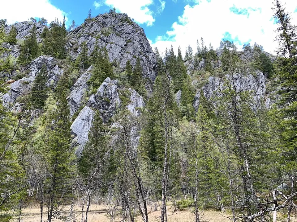
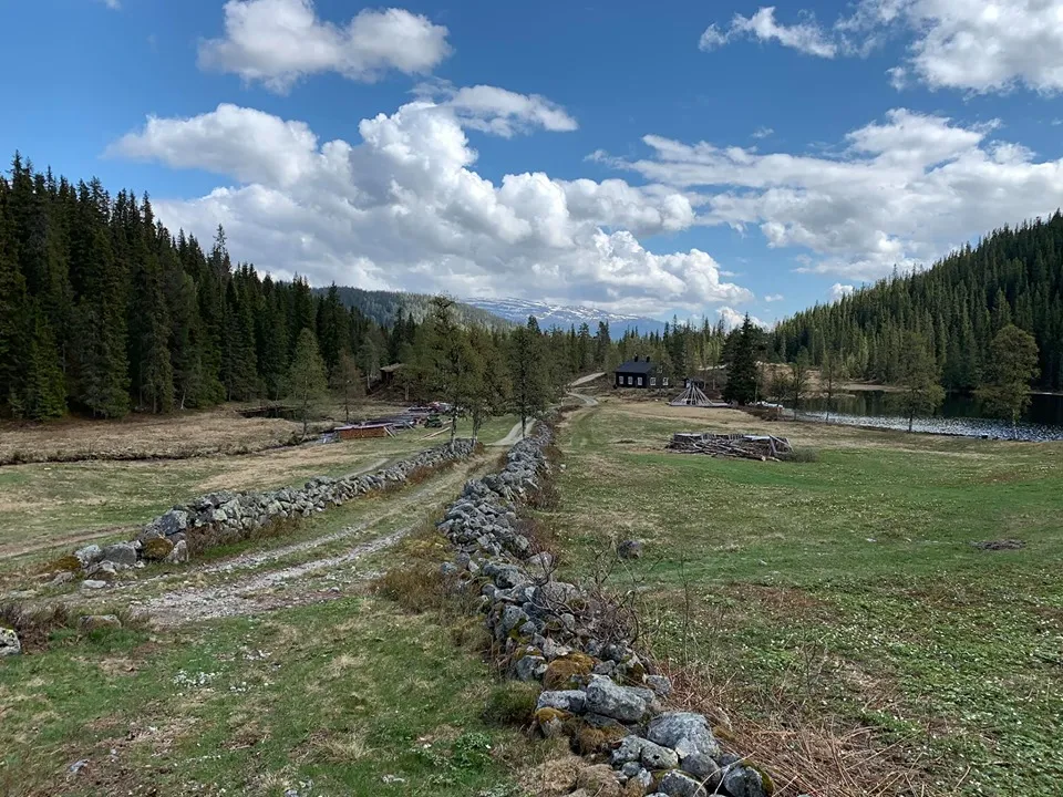
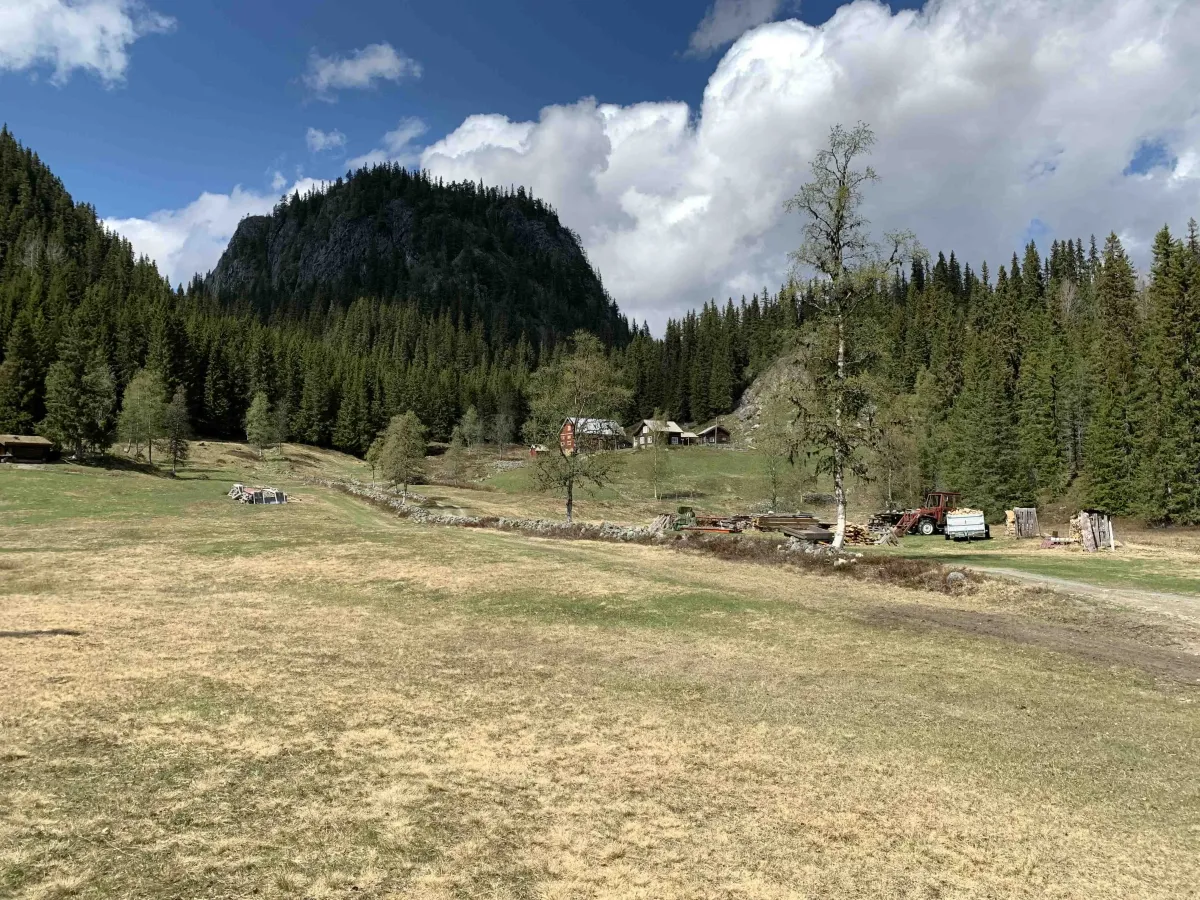
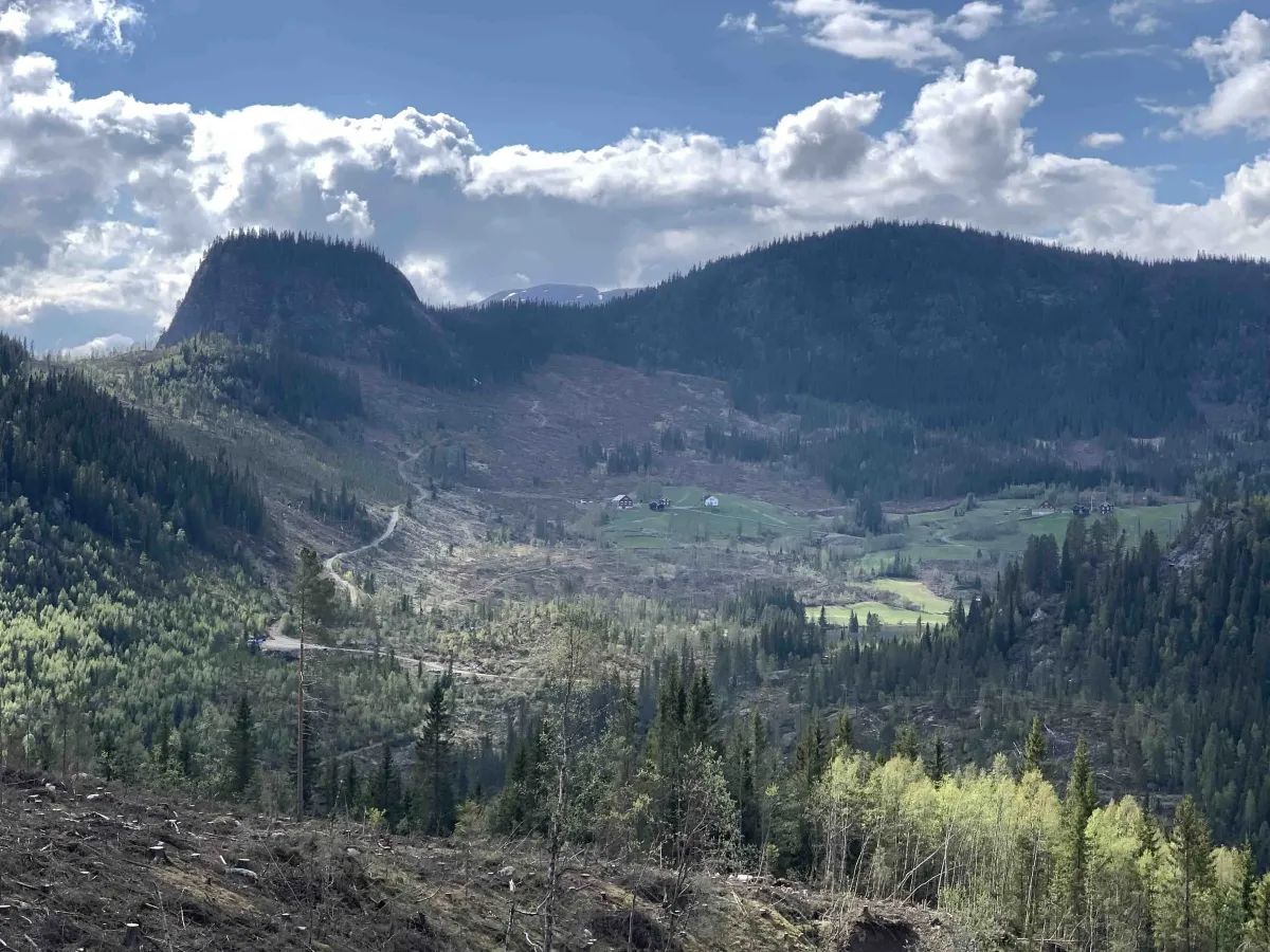
You can start from Svartdal and walk up the lush hills towards Skaret - the highest point on the trail. This direction provides the most climb at the start, but also great views back towards Høydalsmo, Bandak and the mountains to the west.
Alternatively, you can start from Fossheim in Åmotsdal, where you follow the forest road and head towards Skaret from the opposite side. This direction is somewhat slower at the start and may be a better choice for those who want a gentler climb.
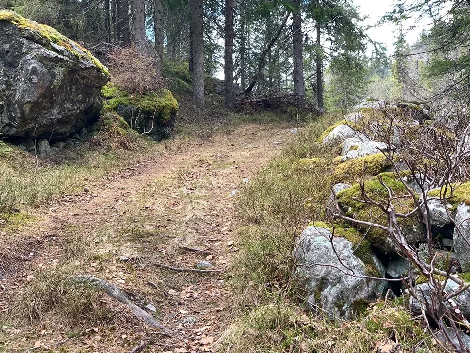
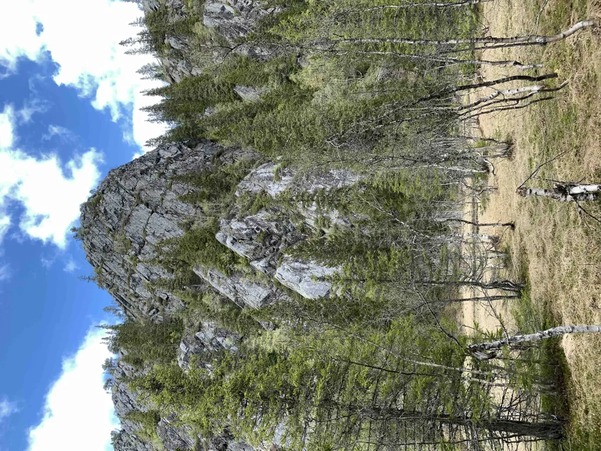
Whichever way you go, you'll follow a good and clear path/road through beautiful mountain scenery, with forests, marshes and open areas, and several information boards along the way that tell you about historical use, farm management and traffic in earlier times.
Historical context:
Skarsvegen was once an important route between the villages - used to transport people, cattle and goods. It has been used by farm girls, traders and churchmen for generations, and parts of the route are still intact as a living cultural trail.
Facts about the hike:
- Length: Approx. 7-8 km one way
- Highest point: Skaret - approx. 760 m above sea level
- Gradient: Never, somewhat steeper from Svartdal
- Time: 2.5-4 hours, depending on direction and pace
- Level: Medium - suitable for most people
- Surface: Gravel road, tractor road and path
Hiking tips:
- Suitable as a day trip with a car shuttle at one end
- Walk back and forth for a good training day
- Take the time to read the signs - there's a lot of local history here
- Suitable for spring, summer and autumn - especially in late summer sun and autumn colors
Skarsvegen is an old road that connects Åmotsdal and Svartdal and offers a unique experience of nature, culture and history. This is a great hike for those who want to walk a slowly ascending mountain road with views, information boards and a feeling of walking in the footsteps of those who walked here before you.
Hiking route and choice of direction:
You can start from Svartdal and walk up the lush hills towards Skaret - the highest point on the trail. This direction provides the most climb at the start, but also great views back towards Høydalsmo, Bandak and the mountains to the west.
Alternatively, you can start from Fossheim in Åmotsdal, where you follow the forest road and head towards Skaret from the opposite side. This direction is somewhat slower at the start and may be a better choice for those who want a gentler climb.
Whichever way you go, you'll follow a good and clear path/road through beautiful mountain scenery, with forests, marshes and open areas, and several information boards along the way that tell you about historical use, farm management and traffic in earlier times.
Historical context:
Skarsvegen was once an important route between the villages - used to transport people, cattle and goods. It has been used by farm girls, traders and churchmen for generations, and parts of the route are still intact as a living cultural trail.
Facts about the hike:
- Length: Approx. 7-8 km one way
- Highest point: Skaret - approx. 760 m above sea level
- Gradient: Never, somewhat steeper from Svartdal
- Time: 2.5-4 hours, depending on direction and pace
- Level: Medium - suitable for most people
- Surface: Gravel road, tractor road and path
Hiking tips:
- Suitable as a day trip with a car shuttle at one end
- Walk back and forth for a good training day
- Take the time to read the signs - there's a lot of local history here
- Suitable for spring, summer and autumn - especially in late summer sun and autumn colors
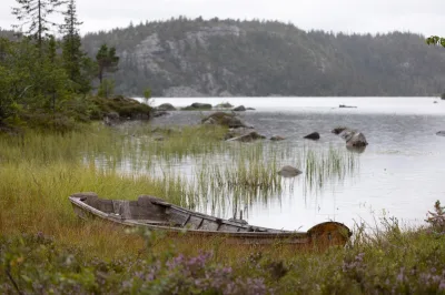
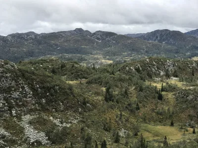
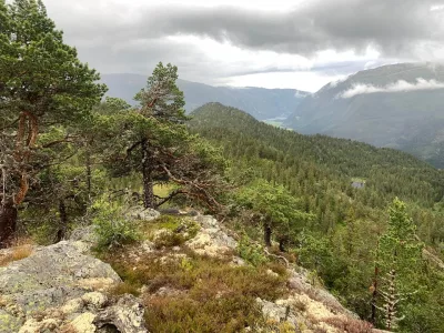
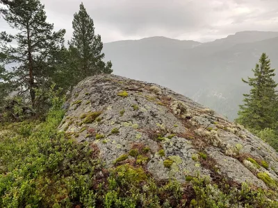
Photos (3)
1 / 3
User photos (3)
1 / 3
Practical info
- Direction
- tur-retur
- Season
- Summer
- Trail quality
- 4/5
- Solitude
- 4/5
Got any good trail tips?
Seljord
Telemark
fintur.no
Telemark
fintur.no