Blåtjønnfjellet

Fee
The road or car park has a fee. Bring small change. Some take cards and Vipps.
Weather forecast
Hentar vêrdata…
Kjelde: Yr.no (Meteorologisk institutt)
Map and route
S Start
M Finish
▲ Highest point
▼ Lowest point
km Main route
↕ m Elevation
About this hike
Blåtjønnfjell - high mountain adventure between Seljord and Hjartdal
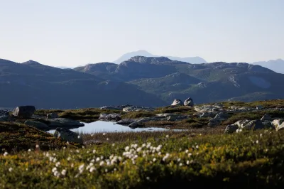
This long-distance hike to Blåtjønnfjellet (1234 m above sea level) is a gem for those who enjoy longer hikes with rugged scenery, sweeping views and a good physical challenge. Part of the hike is in Seljord, but most of it is in the mountain area towards Hjartdal. Particularly in the autumn, just before the snow arrives, there is a magical atmosphere in the mountains here - clear light, quiet landscapes and glowing autumn colors.
Starting point:
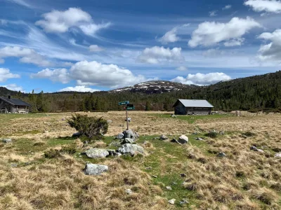
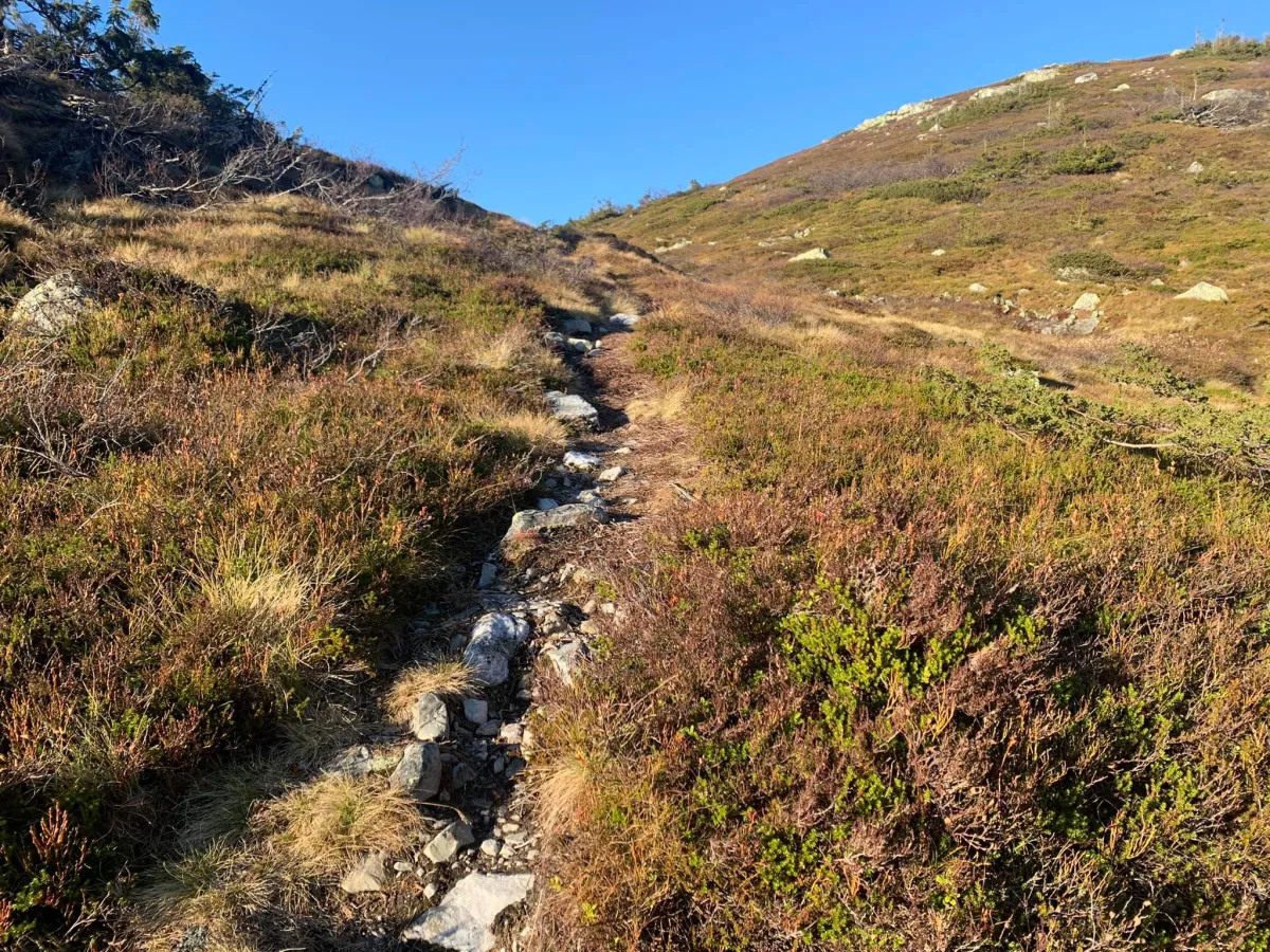
The hike starts at the bottom of Grunningsdalen, at Slåke, where new and beautiful bridges have now been built. At the edge of the forest, you'll find the start of the old path, which leads you to the Østre Slåke-staul, close to the cabin field.
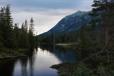
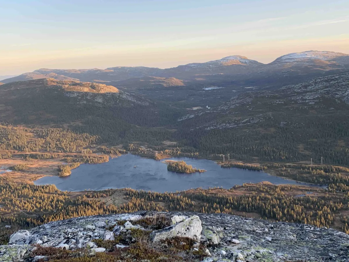
From there you continue up along the Sudslåkåbekken stream, and the trail climbs towards Blåtjønn - an idyllic mountain lake surrounded by steep slopes. This is where the real climb begins, and after several long switchbacks and some steep sections, you reach the top of Blåtjønnfjellet, 1234 meters above sea level.
But the tour does not stop here:
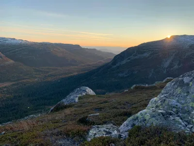
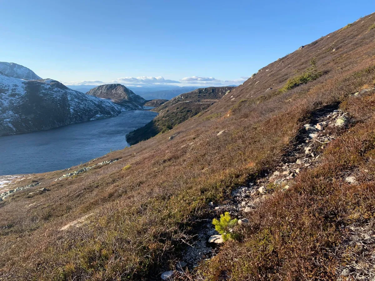
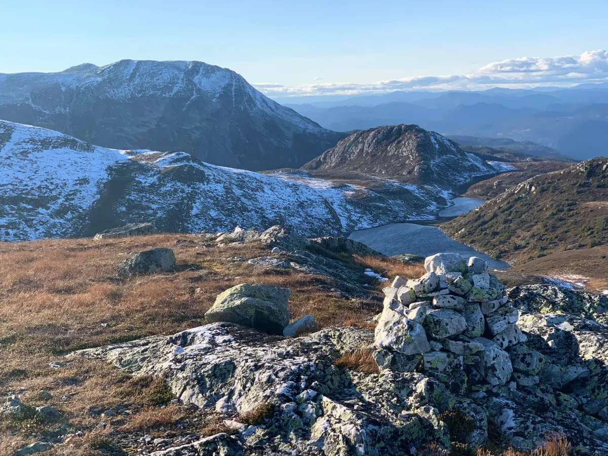
The next peak is about 60 meters down - and you continue up to Gryvenuten (1175 m), which offers fantastic views of Londalen, with the tufts and the old cultural landscape below.
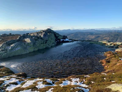
After Gryvenuten you turn your nose towards home - over Vesledalen and up on the other side of the lake. Here you'll find a series of caves and viewpoints before finally reaching Slåkånuten (1189 m), the last high point before descending to Slåke and Grunningsdalen.
Facts about the hike:
- Length: approx. 13 km round trip
- Total ascent: 1058 vertical meters
- Highest point: Blåtjønnfjellet, 1234 m above sea level
- Level: Demanding - for mountain hikers with good fitness
Hiking tips:
- Start early - the hike takes all day.
- Good hiking boots and a map/GPS are essential.
- Bring a packed lunch and extra clothes - the weather changes quickly in the mountains.
- Mobile coverage can vary - call home before you go.
This long-distance hike to Blåtjønnfjellet (1234 m above sea level) is a gem for those who enjoy longer hikes with rugged scenery, sweeping views and a good physical challenge. Part of the hike is in Seljord, but most of it is in the mountain area towards Hjartdal. Particularly in the autumn, just before the snow arrives, there is a magical atmosphere in the mountains here - clear light, quiet landscapes and glowing autumn colors.
Starting point:
The hike starts at the bottom of Grunningsdalen, at Slåke, where new and beautiful bridges have now been built. At the edge of the forest, you'll find the start of the old path, which leads you to the Østre Slåke-staul, close to the cabin field.
From there you continue up along the Sudslåkåbekken stream, and the trail climbs towards Blåtjønn - an idyllic mountain lake surrounded by steep slopes. This is where the real climb begins, and after several long switchbacks and some steep sections, you reach the top of Blåtjønnfjellet, 1234 meters above sea level.
But the tour does not stop here:
The next peak is about 60 meters down - and you continue up to Gryvenuten (1175 m), which offers fantastic views of Londalen, with the tufts and the old cultural landscape below.
After Gryvenuten you turn your nose towards home - over Vesledalen and up on the other side of the lake. Here you'll find a series of caves and viewpoints before finally reaching Slåkånuten (1189 m), the last high point before descending to Slåke and Grunningsdalen.
Facts about the hike:
- Length: approx. 13 km round trip
- Total ascent: 1058 vertical meters
- Highest point: Blåtjønnfjellet, 1234 m above sea level
- Level: Demanding - for mountain hikers with good fitness
Hiking tips:
- Start early - the hike takes all day.
- Good hiking boots and a map/GPS are essential.
- Bring a packed lunch and extra clothes - the weather changes quickly in the mountains.
- Mobile coverage can vary - call home before you go.
Photos (3)
1 / 3
User photos (1)
Practical info
- Direction
- tur-retur
- Season
- Summer
- Trail quality
- 3/5
- Solitude
- 6/5
Got any good trail tips?
Hjartdal
Telemark
fintur.no
Telemark
fintur.no