Spådomsnuten
Fee
The road or car park has a fee. Bring small change. Some take cards and Vipps.
Weather forecast
Hentar vêrdata…
Kjelde: Yr.no (Meteorologisk institutt)
Map and route
S Start
M Finish
▲ Highest point
▼ Lowest point
km Main route
km Alternativ rute
↕ m Elevation
About this hike
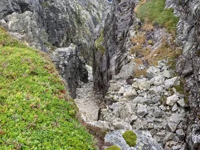
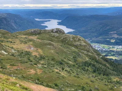
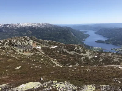
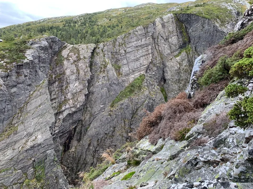
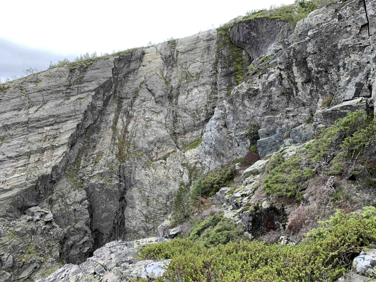
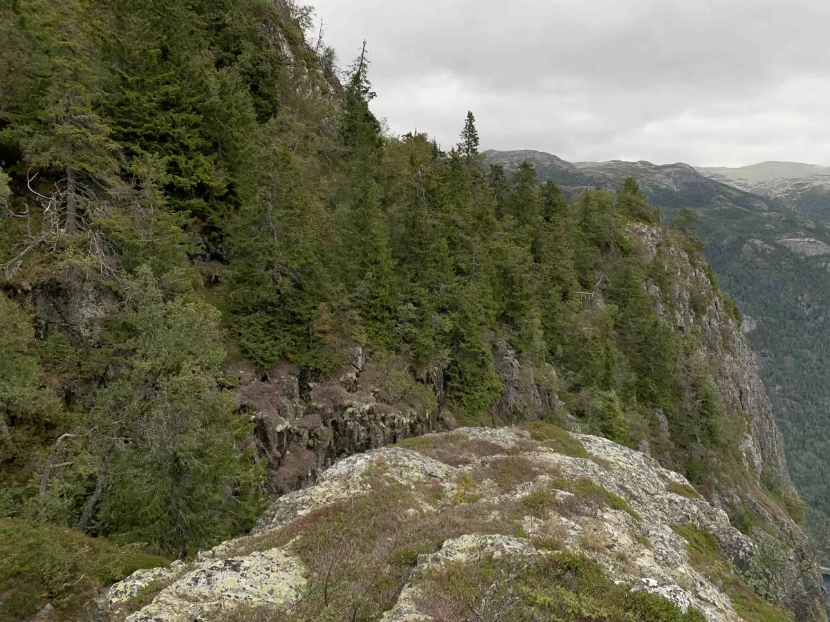
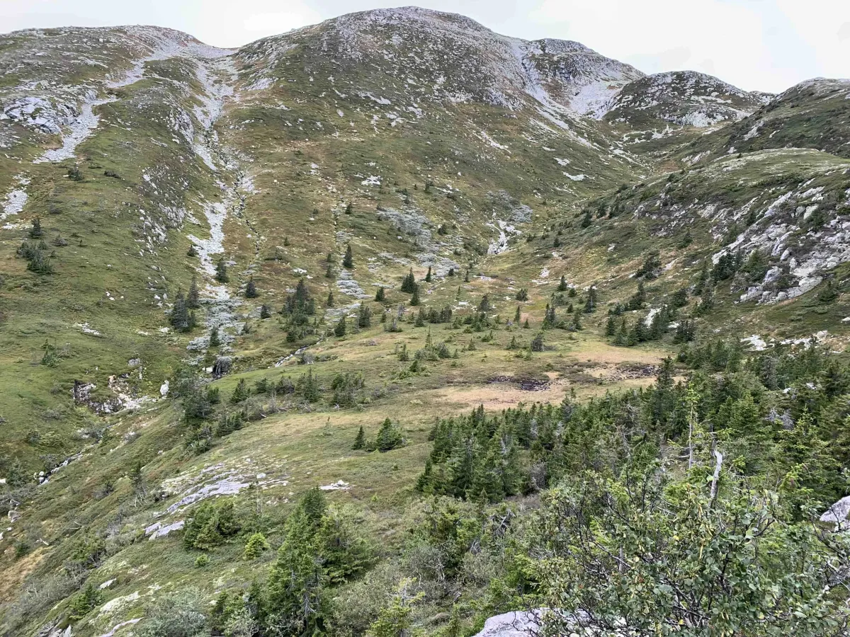
Spådomsnuten towers in the Skorve mountain massif and is easy to recognize from the Flatsjå side, where it rises steeply and markedly from the landscape. This is a breezy and wild hike that is not marked - but animal tracks and old paths will help you much of the way up.
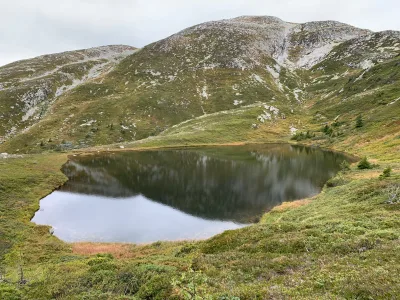
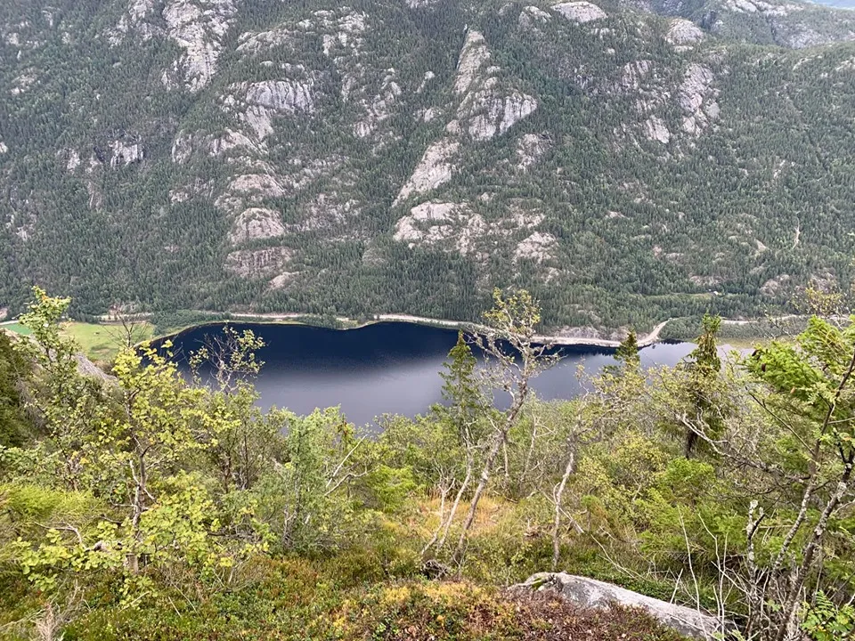
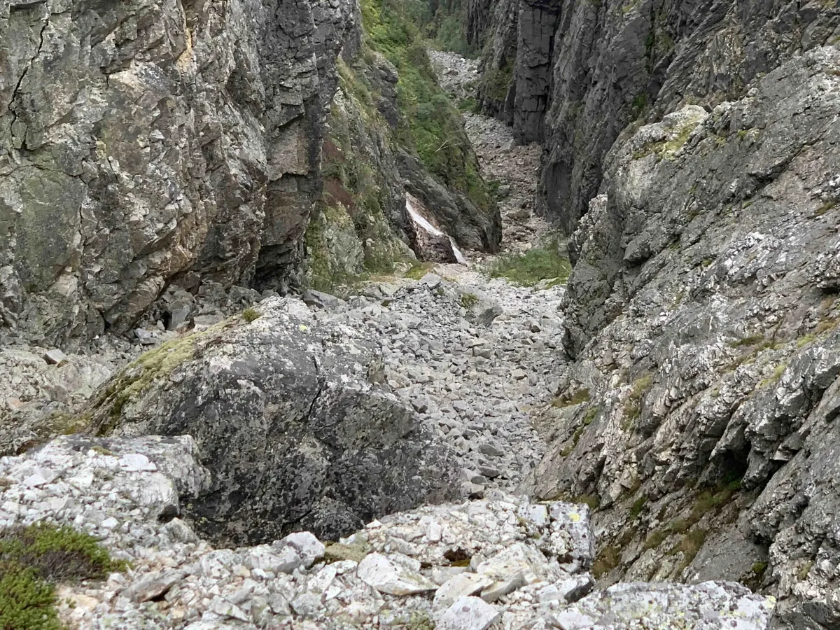
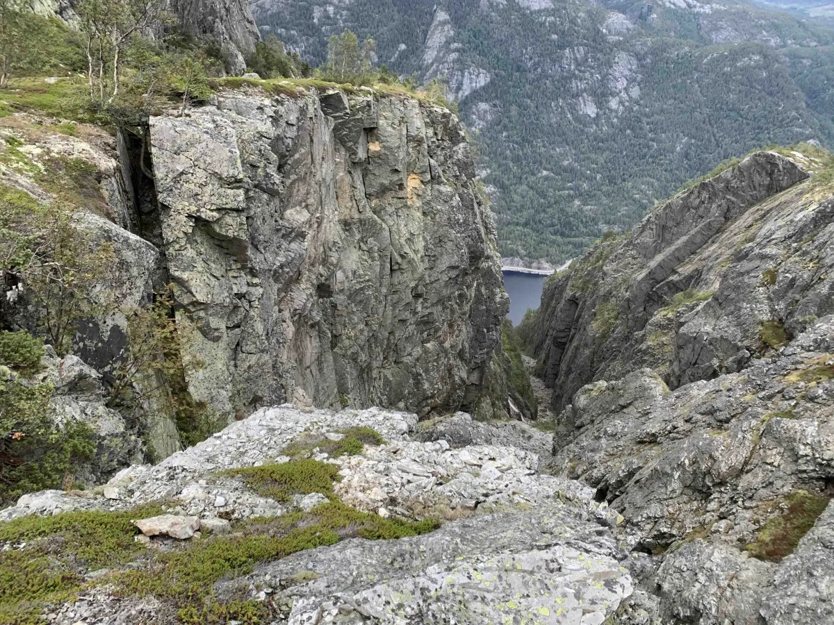
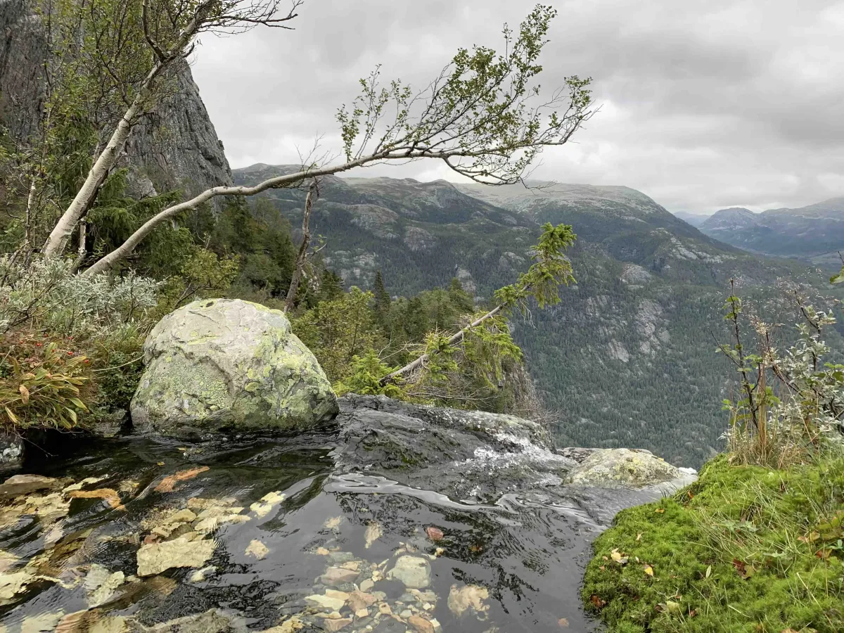
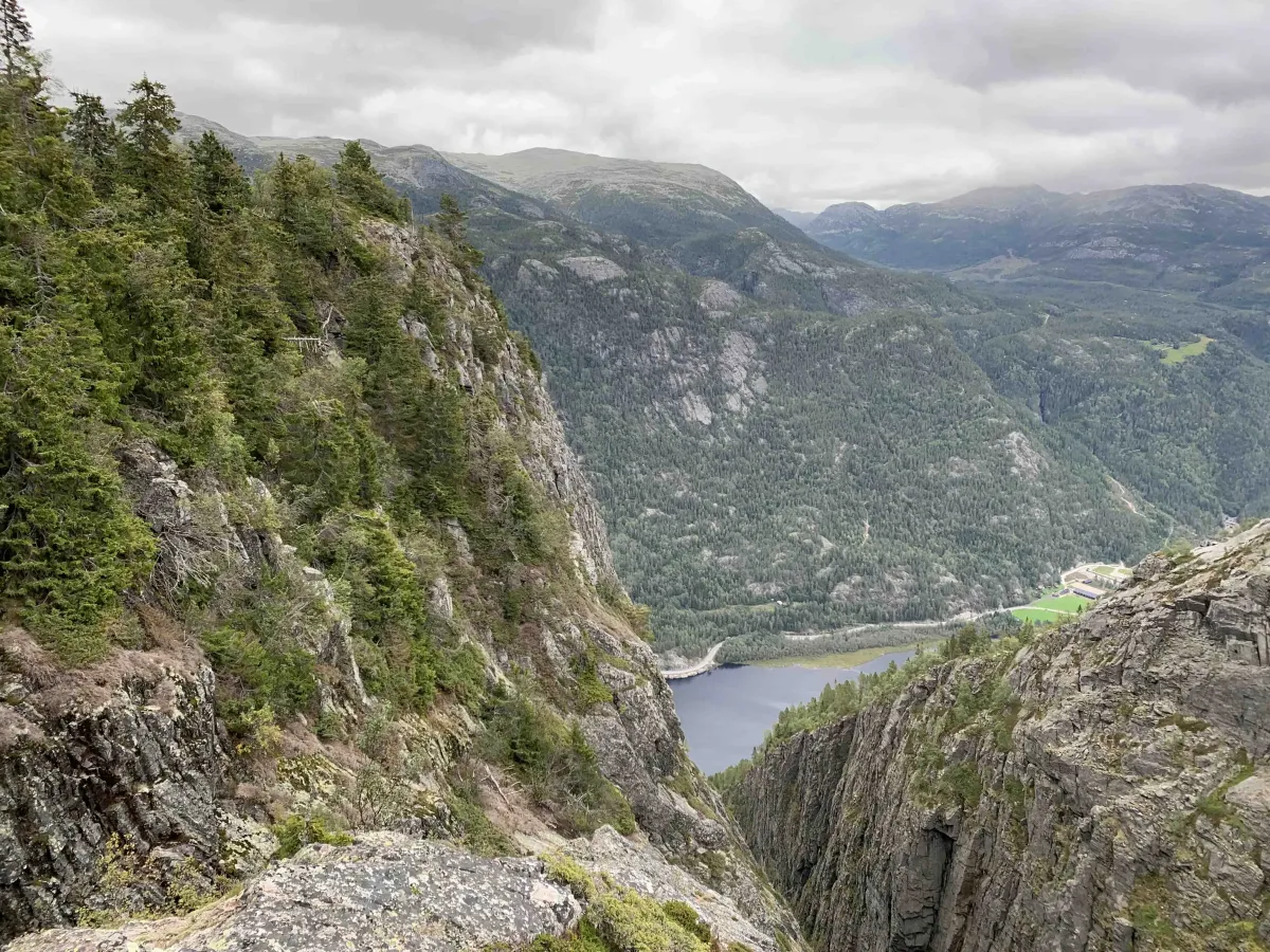
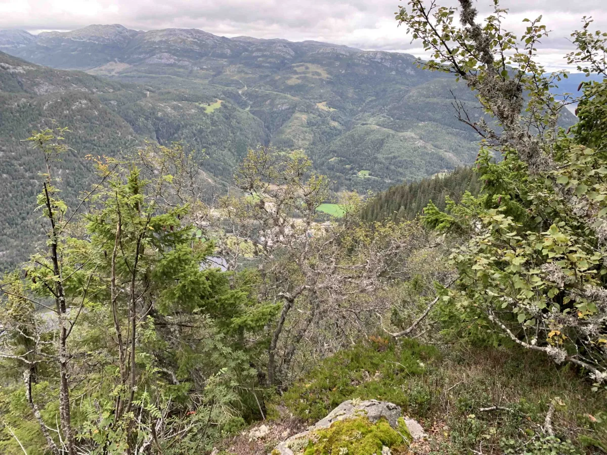
You start the hike from Kivledalen and head up the hillside. The path is indistinct in places, but it is possible to find your way for mountain hikers with an eye for terrain and direction. You gain height meters steadily - a total of 634 meters up - and are eventually rewarded with an incomparable view of the Skorve plateau, towards Flatsjå and further into West Telemark.
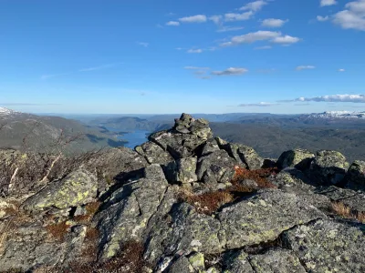
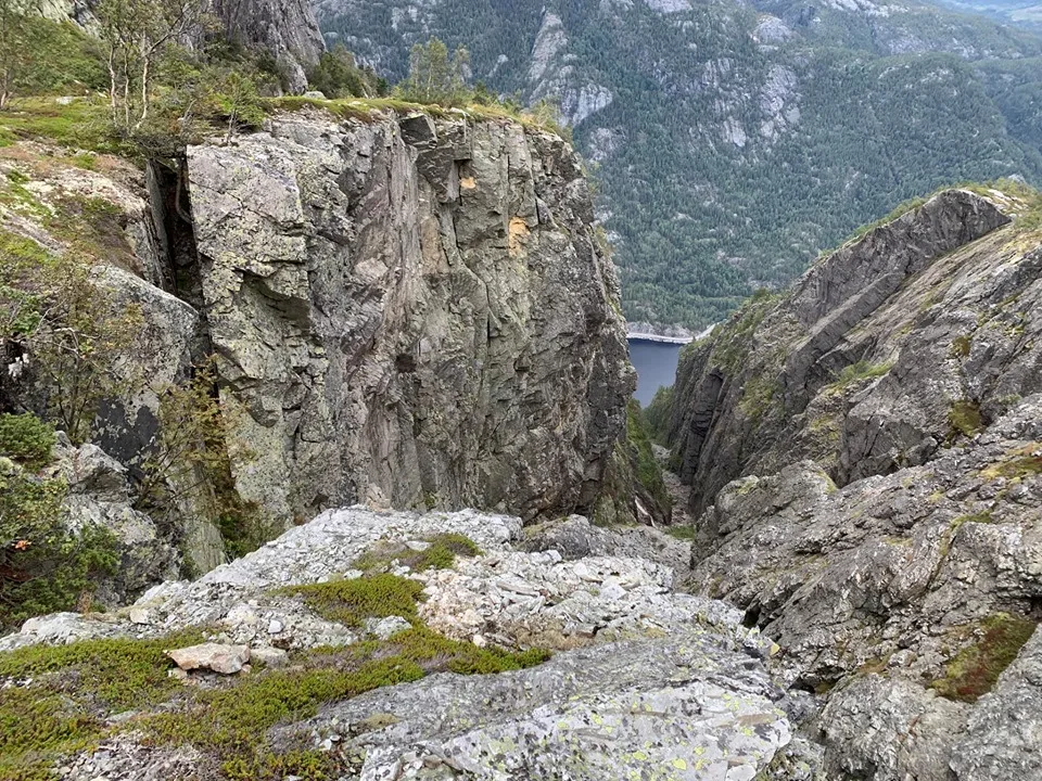
A little below the main summit is Spådomskalven (996 meters above sea level), a steep and exposed cliff that juts out into the landscape. It is possible to venture out here, but it is not recommended - and must be done at your own risk and with great caution.
This is a trip for those who like untouched nature and challenging mountain terrain, without necessarily following T-marked trails.
Length: Approx. 7-8 km round trip
Time: 3-4 hours
Altitude: 1030 m above sea level (634 m ascent)
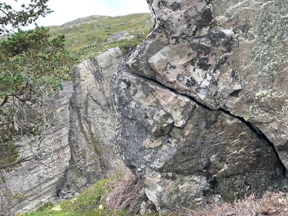
Terrain: Animal trails, paths, scree and bare rock.
Difficulty level: Demanding - unmarked route
Suitable for: Experienced hikers, adventurers, those who want to see Skorve from a new perspective
You start the hike from Kivledalen and head up the hillside. The path is indistinct in places, but it is possible to find your way for mountain hikers with an eye for terrain and direction. You gain height meters steadily - a total of 634 meters up - and are eventually rewarded with an incomparable view of the Skorve plateau, towards Flatsjå and further into West Telemark.
A little below the main summit is Spådomskalven (996 meters above sea level), a steep and exposed cliff that juts out into the landscape. It is possible to venture out here, but it is not recommended - and must be done at your own risk and with great caution.
This is a trip for those who like untouched nature and challenging mountain terrain, without necessarily following T-marked trails.
Length: Approx. 7-8 km round trip
Time: 3-4 hours
Altitude: 1030 m above sea level (634 m ascent)
Terrain: Animal trails, paths, scree and bare rock.
Difficulty level: Demanding - unmarked route
Suitable for: Experienced hikers, adventurers, those who want to see Skorve from a new perspective
Photos (3)
1 / 3
Videos (1)
Utpå Spådomsnuten
Trail story

Flodbølge
On the eastern side of Skorve, down towards Flatsjå, there is a part of the mountain called Spådomsnuten, or Spådomsklaven. It is said that the day three sisters from Flatdal get married on the same day, this part of the mountain will collapse into Flatsjå. Others say it will happen when there is a town between Vallaråi and Bygdaråi. Then, according to the legend, a tidal wave will be created that will wash over the whole of Flatdal and all the way up to Nutheim.
User photos (11)
1 / 11

Practical info
- Direction
- tur-retur
- Season
- Summer
- Trail quality
- 4/5
- Solitude
- 5/5
Got any good trail tips?
Seljord
Telemark
fintur.no
Telemark
fintur.no