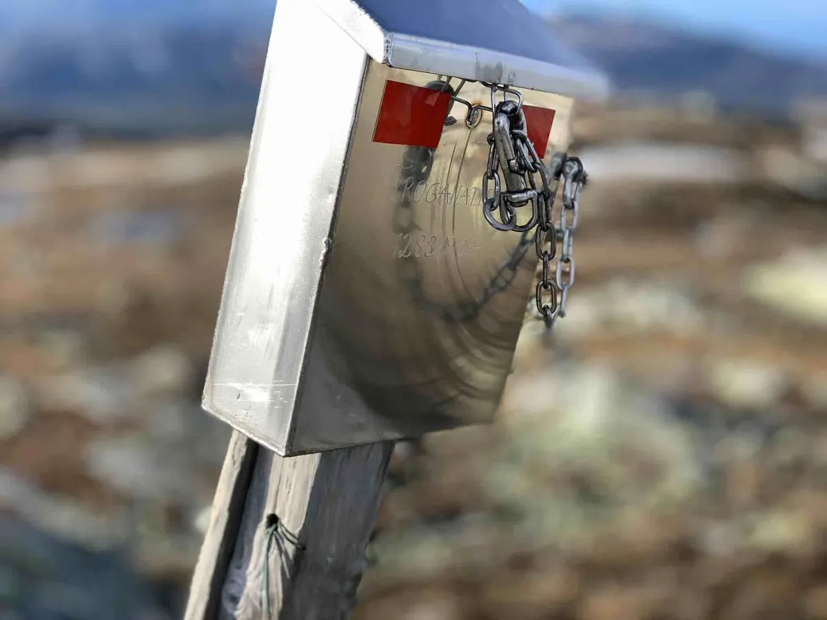
Troganatten
Weather forecast
Hentar vêrdata…
Kjelde: Yr.no (Meteorologisk institutt)
Map and route
S Start
M Finish
▲ Highest point
▼ Lowest point
km Main route
↕ m Elevation
About this hike
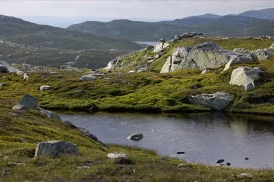
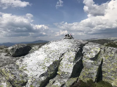
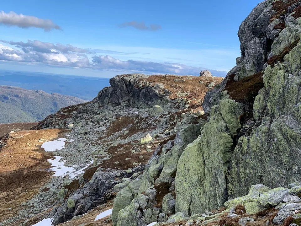
Troganatten (approx. 1110 m) is one of the most striking and steepest peaks on the south side of the Lifjell plateau. From here you get a very special view - both inside the mountain massif towards Lifjell in the north, out towards Bø in the south, and diagonally towards Skorvefjella in the west and Luksefjell in the east. This is a hiking destination for those who like contrasts - steep mountains and wide open spaces.
Access and route choice:
You can reach Troganatten from several sides:
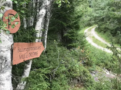
- From Manheim: Start from Veslestaul or the parking lot at Ballongfararsteinen. This is one of the shortest and most frequently used routes, but has a good gradient and views all the way.
- From Vefall in Seljord: Provides a longer and quieter route up through forest and moorland, and can be combined with several small paths along the way.
- From Bø: Start in the upper parts of Bø or at Vreim and walk up towards the mountain border - this is a long and demanding route, but provides a lot of variation.
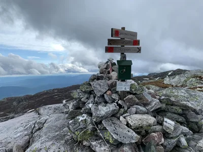
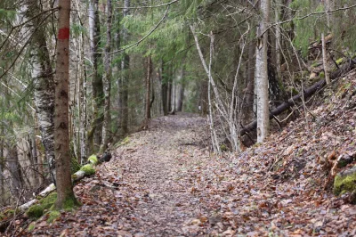
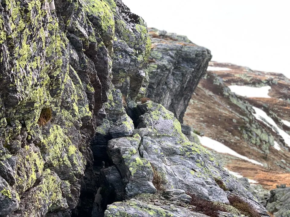
Regardless of which way you come from, you will eventually meet the steep mountain that is Troganatten. Here, the trail climbs through rock, scree and heather moorland, and you really get to feel the altitude. The last part to the top is breezy, but not technically demanding.
View from the top:
- To the north: The entire Lifjell plateau - from Blomtjønneggin and Røysdalsnuten to Astridnatten.
- To the south: Bøbygda, with Norsjø and Gygrestolen in the distance
- To the west: Skorve, Gaustatoppen and the mountain passes towards Vinje
- To the east: Luksefjell, Høyslass and south-eastern parts of Midt-Telemark
This is an exposed and magnificent vantage point, but also a place of tranquillity, with views far into both the landscape and the mind.
Facts about the hike (from Veslestaul):
- Length: Approx. 5-6 km one way
- Ascent: Around 600 vertical meters
- Time: 2.5-4 hours round trip
- Level: Moderate to demanding
- Surface: Good paths, primitive and mountainous terrain.
- Marking: Partially marked - feel free to use GPS/map
Hiking tips:
- Perfect for a late afternoon hike with the sun setting behind you.
- Good shoes are important - lots of rocks and rough terrain
- Feel free to combine with Astrid Night or a round trip on southern Lifjell
- Stay on the trail - there are several steep edges near the top
Access and route choice:
You can reach Troganatten from several sides:
- From Manheim: Start from Veslestaul or the parking lot at Ballongfararsteinen. This is one of the shortest and most frequently used routes, but has a good gradient and views all the way.
- From Vefall in Seljord: Provides a longer and quieter route up through forest and moorland, and can be combined with several small paths along the way.
- From Bø: Start in the upper parts of Bø or at Vreim and walk up towards the mountain border - this is a long and demanding route, but provides a lot of variation.
Regardless of which way you come from, you will eventually meet the steep mountain that is Troganatten. Here, the trail climbs through rock, scree and heather moorland, and you really get to feel the altitude. The last part to the top is breezy, but not technically demanding.
View from the top:
- To the north: The entire Lifjell plateau - from Blomtjønneggin and Røysdalsnuten to Astridnatten.
- To the south: Bøbygda, with Norsjø and Gygrestolen in the distance
- To the west: Skorve, Gaustatoppen and the mountain passes towards Vinje
- To the east: Luksefjell, Høyslass and south-eastern parts of Midt-Telemark
This is an exposed and magnificent vantage point, but also a place of tranquillity, with views far into both the landscape and the mind.
Facts about the hike (from Veslestaul):
- Length: Approx. 5-6 km one way
- Ascent: Around 600 vertical meters
- Time: 2.5-4 hours round trip
- Level: Moderate to demanding
- Surface: Good paths, primitive and mountainous terrain.
- Marking: Partially marked - feel free to use GPS/map
Hiking tips:
- Perfect for a late afternoon hike with the sun setting behind you.
- Good shoes are important - lots of rocks and rough terrain
- Feel free to combine with Astrid Night or a round trip on southern Lifjell
- Stay on the trail - there are several steep edges near the top
Photos (3)

1 / 3
User photos (1)
Practical info
- Direction
- tur-retur
- Season
- Summer
- Trail quality
- 3/5
- Solitude
- 6/5
Got any good trail tips?
Seljord
Telemark
fintur.no
Telemark
fintur.no