Brennmonuten
Parking Telenessanden
Due to high demand, you must now park at Telenessanden Camping (50,-) about 1 km away.
Weather forecast
Hentar vêrdata…
Kjelde: Yr.no (Meteorologisk institutt)
Map and route
S Start
M Finish
▲ Highest point
▼ Lowest point
km Main route
↕ m Elevation
About this hike
Brennmonuten - short, steep and with one of the most beautiful views of Seljordvatnet
Brennmonuten is one of the more hidden but spectacular viewpoints around Seljordvatnet. The hike is short and steep, and in many ways comparable to the hike to Firingnuten - a short but powerful climb that rewards you with wide views and beautiful rocks.
Starting point:
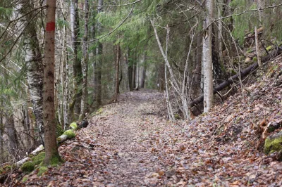
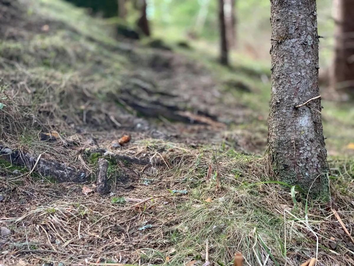
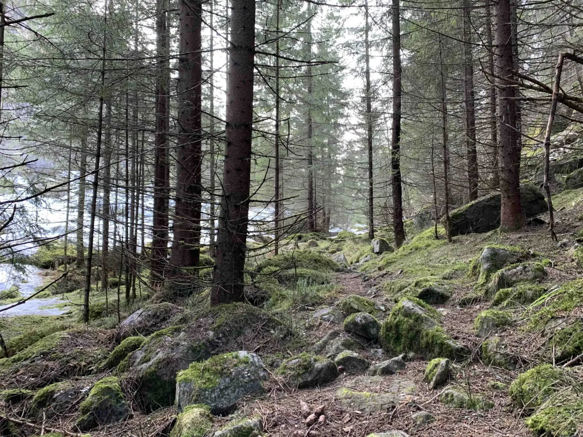
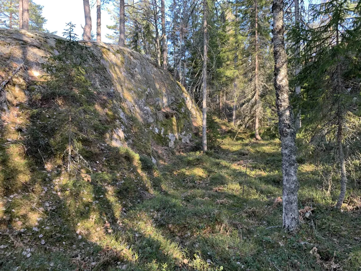
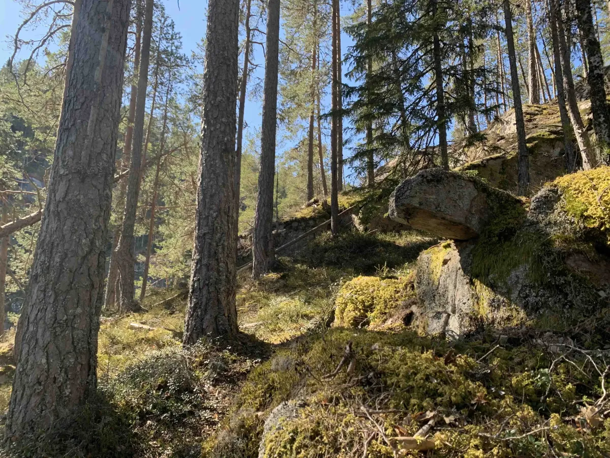
The hike starts at Brennmo, down by Seljordvatnet. From here you follow an old road up the mountainside. The road is overgrown in places, but you can still walk easily between bushes and small trees. Follow the road all the way until it stops - then you are at Østerdalstjønni, a small and quiet lake surrounded by forest and trees.
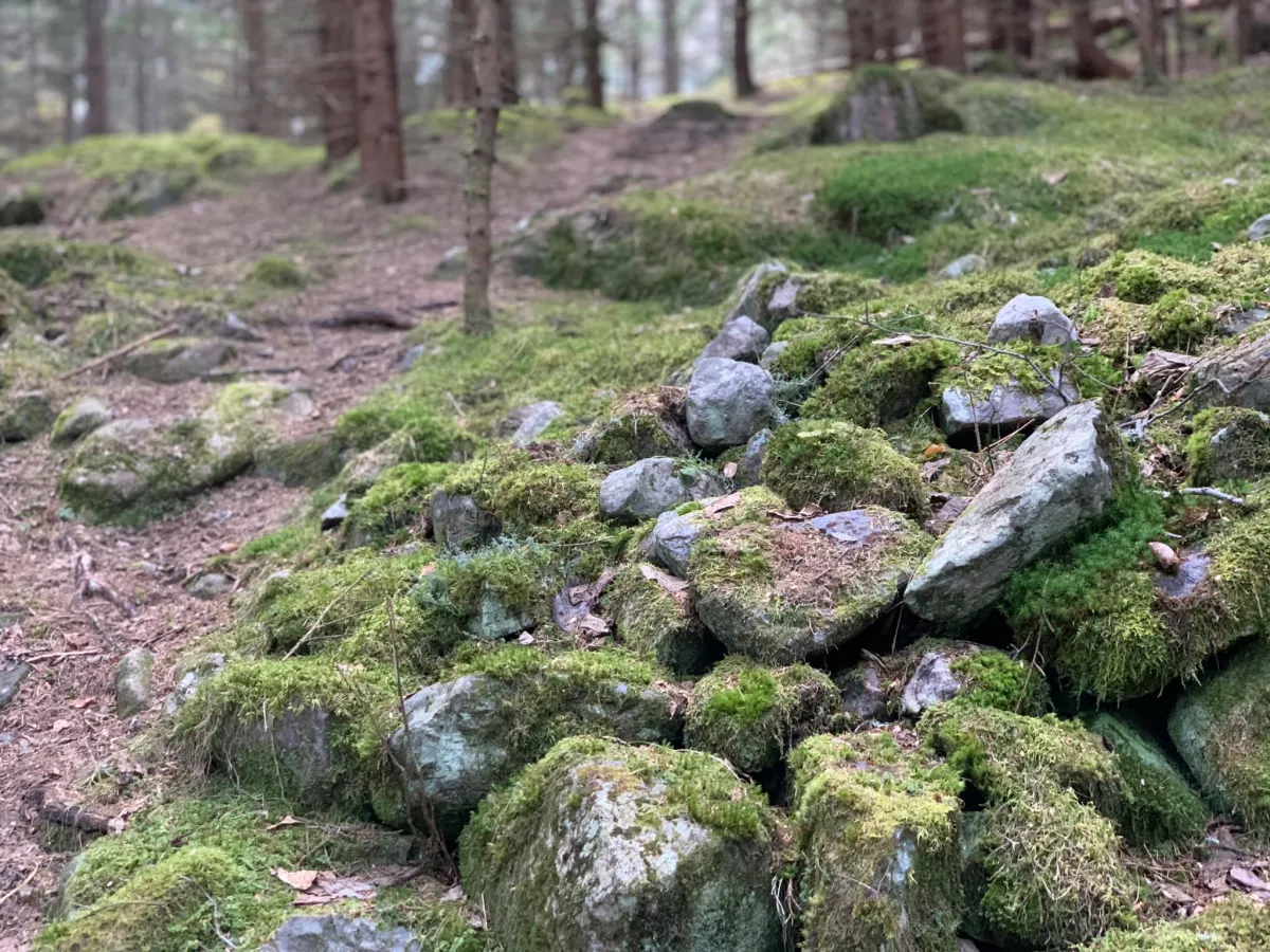
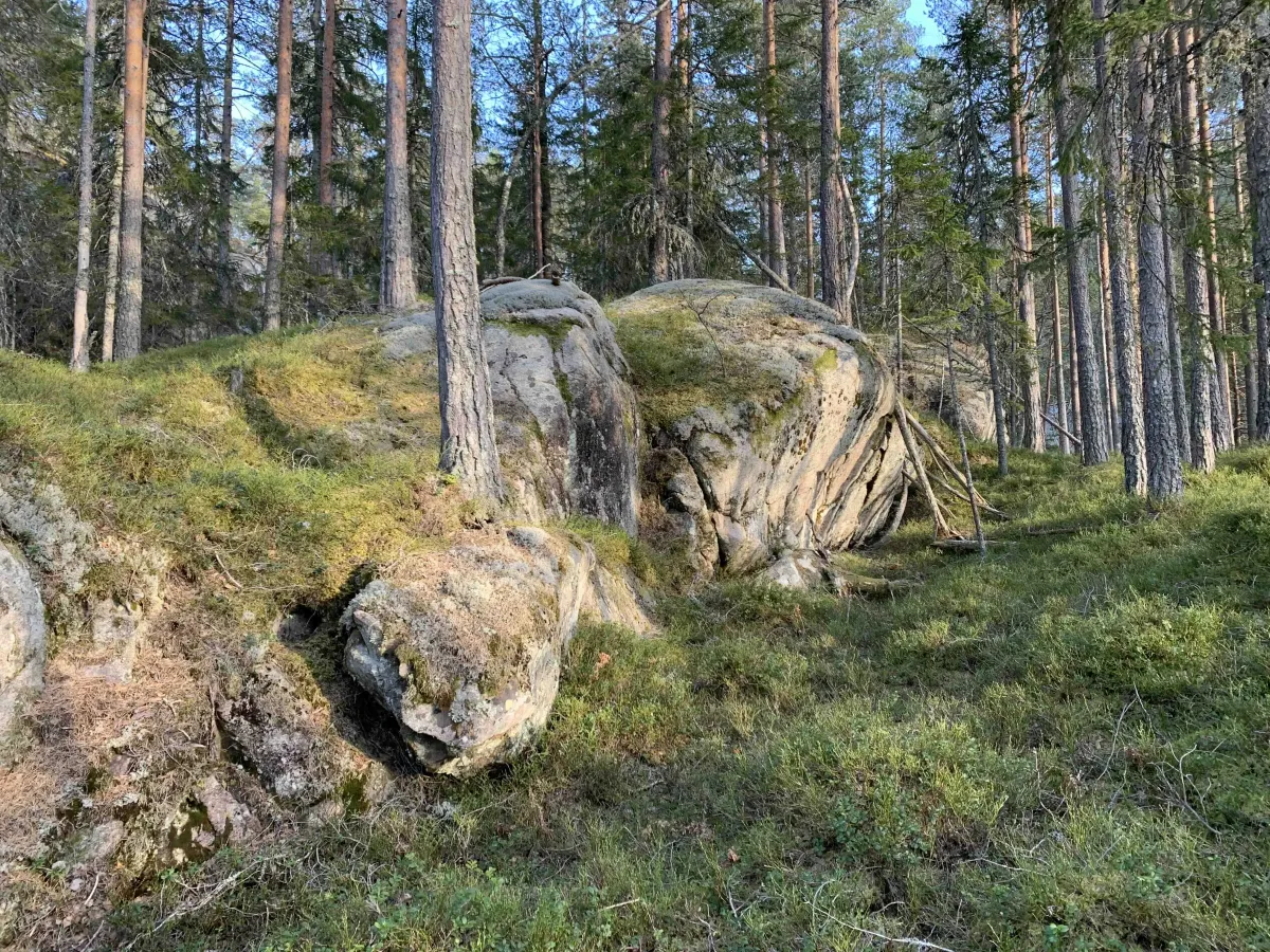
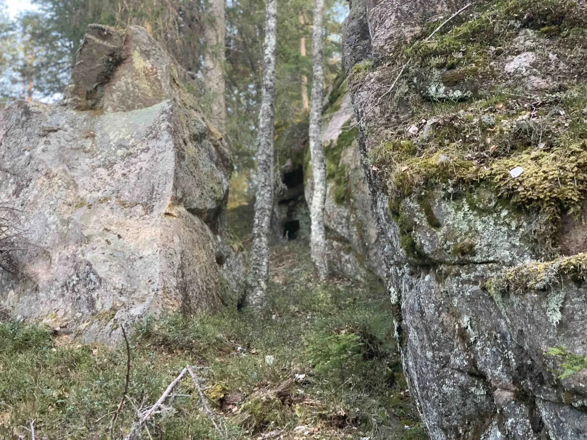
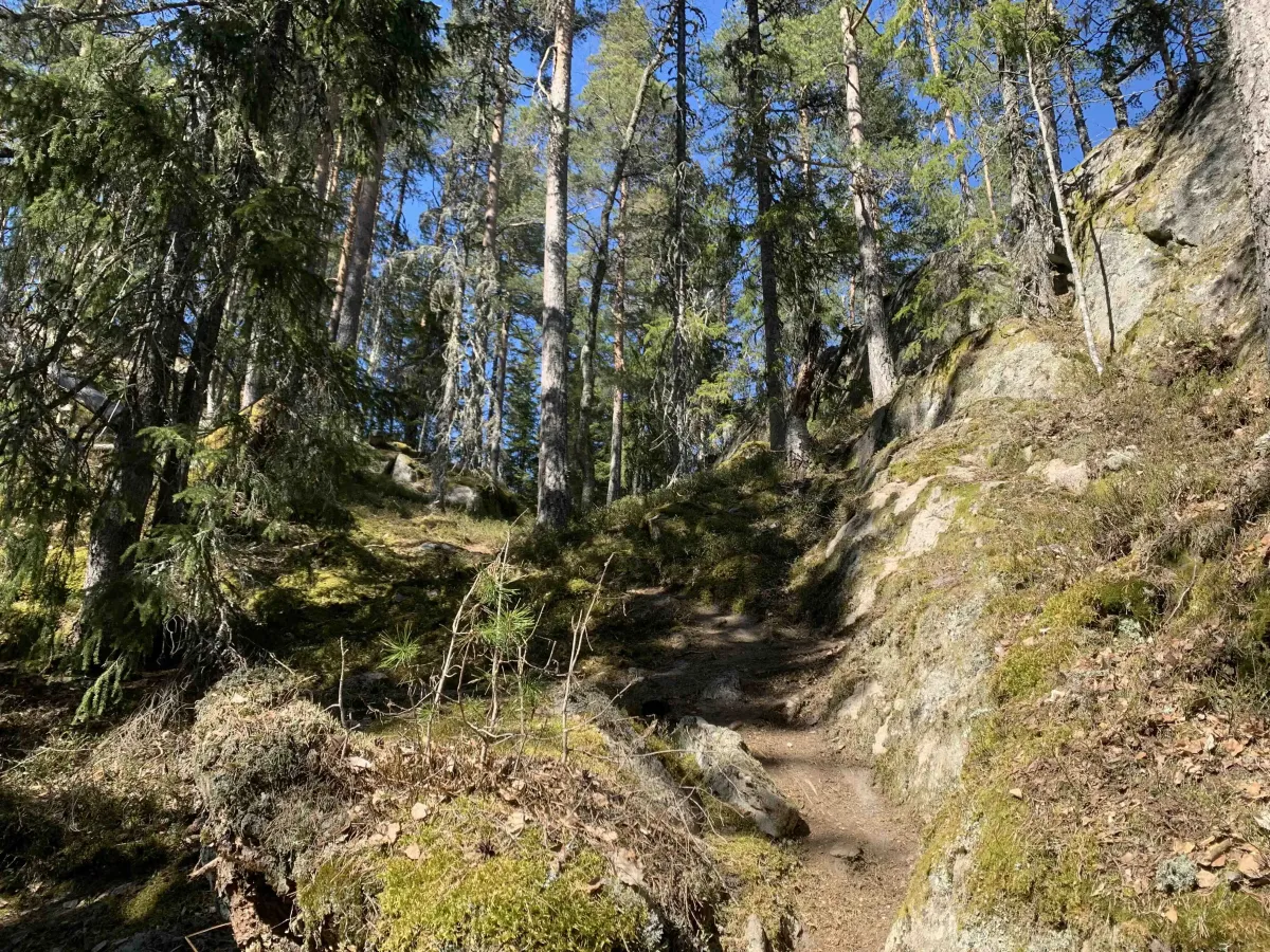
The path continues to the right and further into Oredalen. When you come to a stone wall, turn off the path and head right up the hillside. It's a little indistinct at first, but eventually a path appears that becomes clearer as you climb the hill.
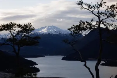
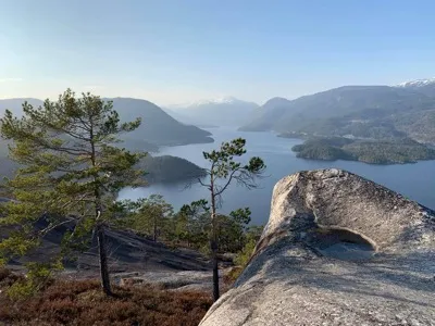
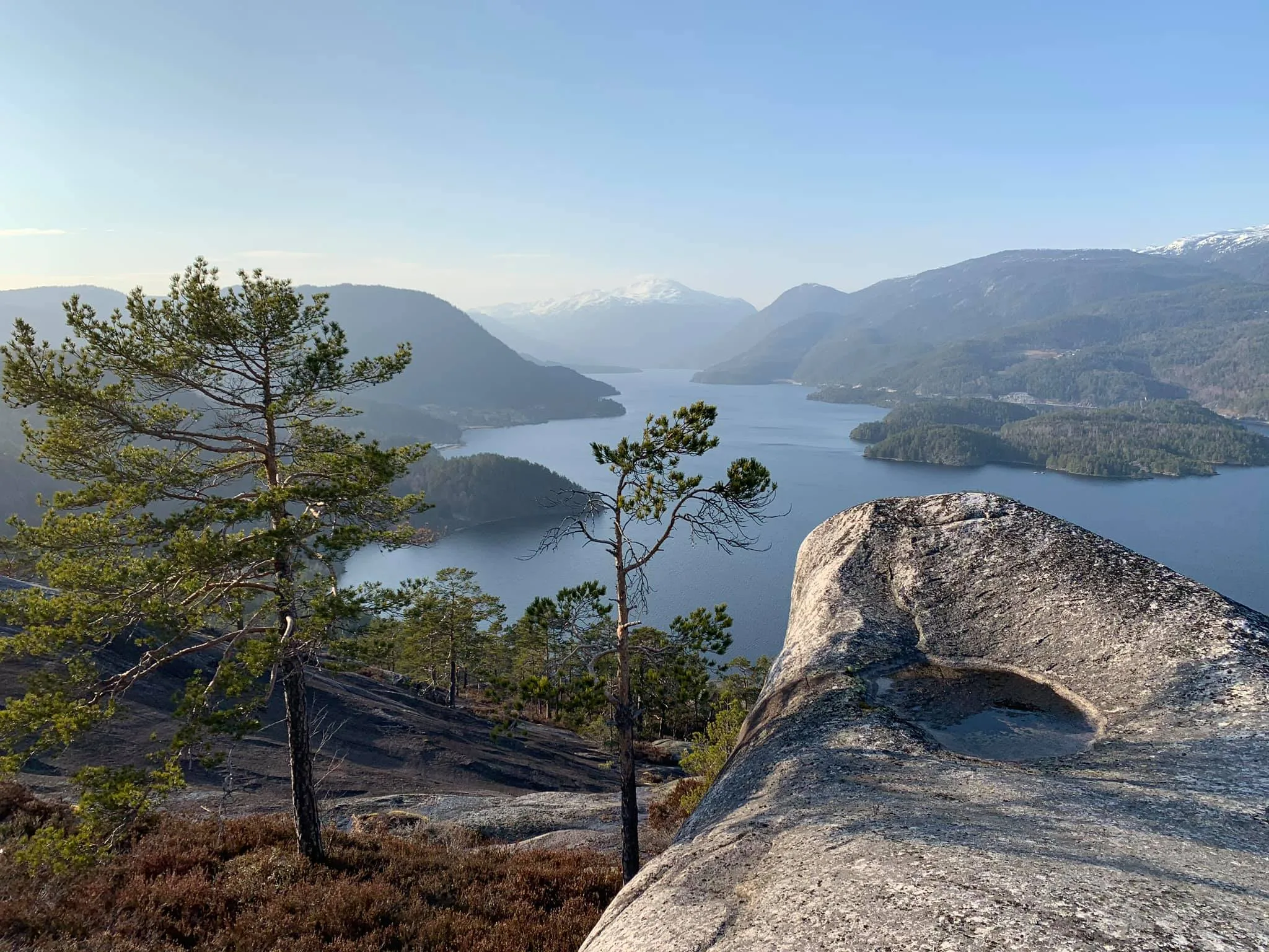
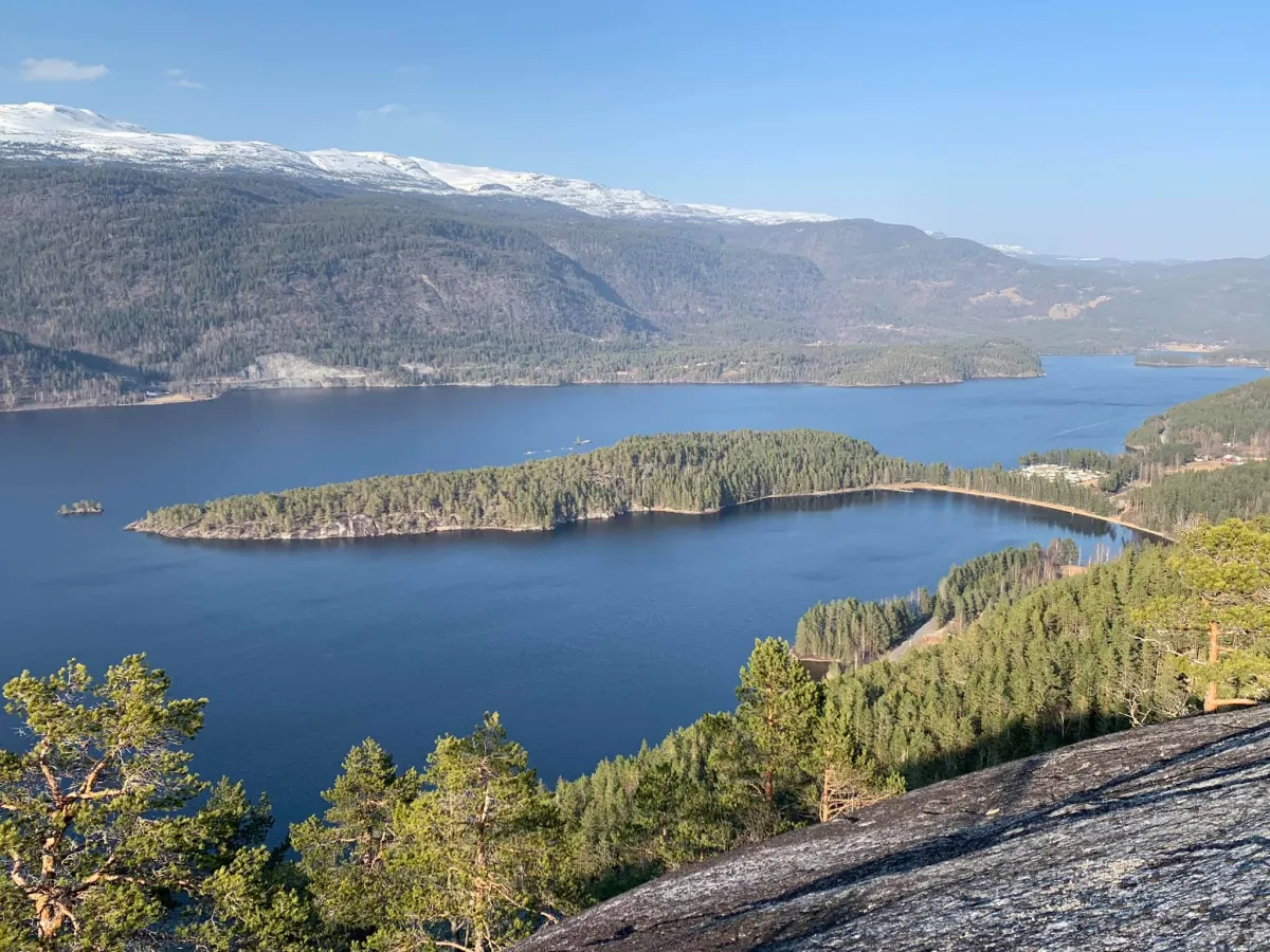
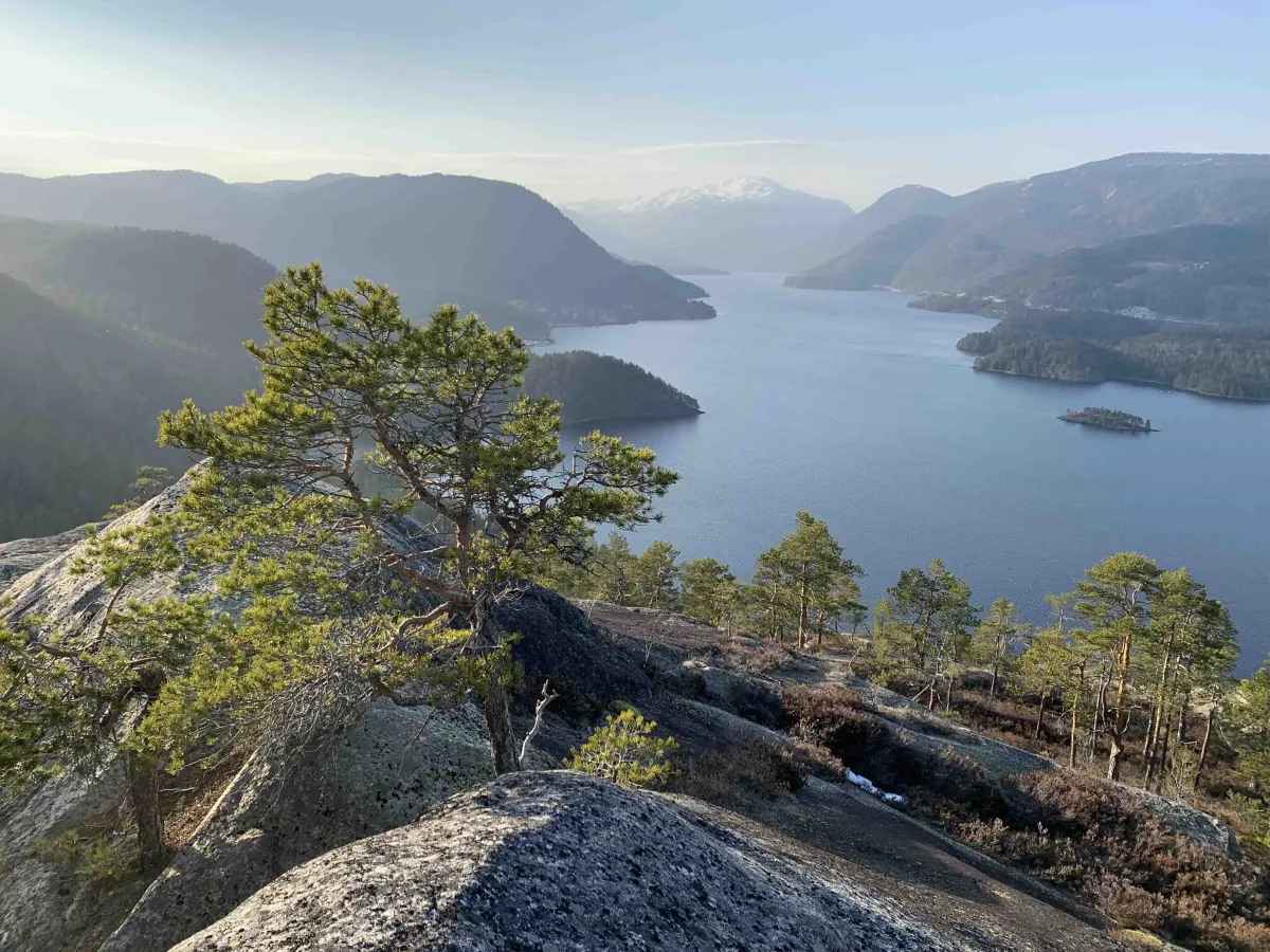
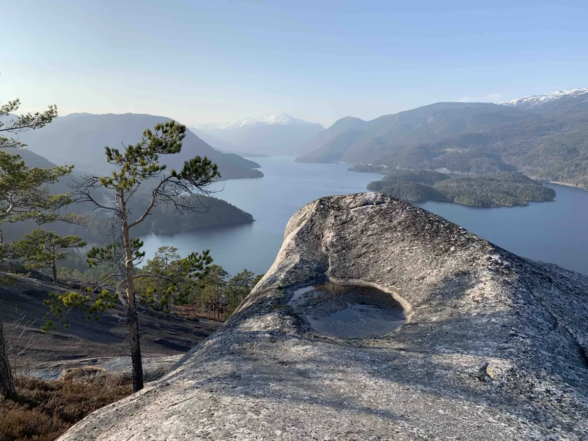
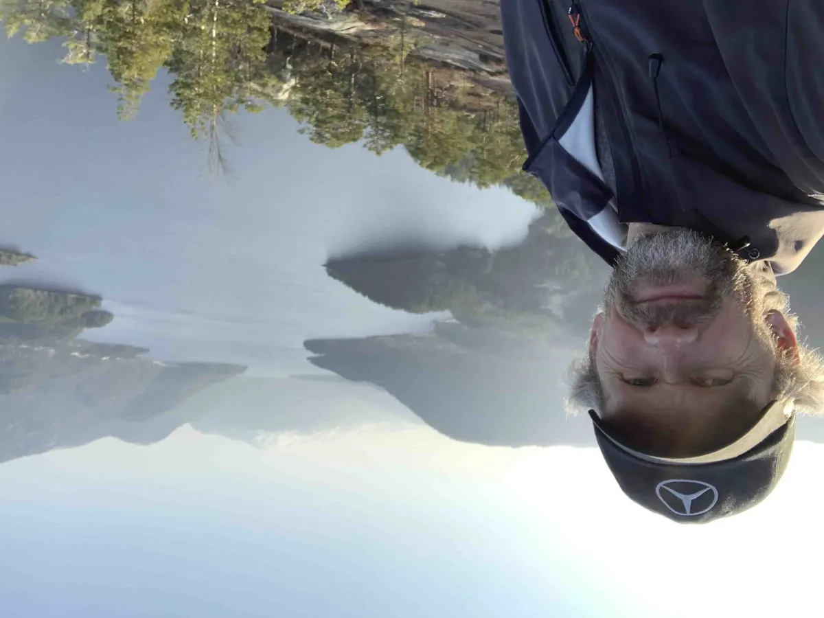
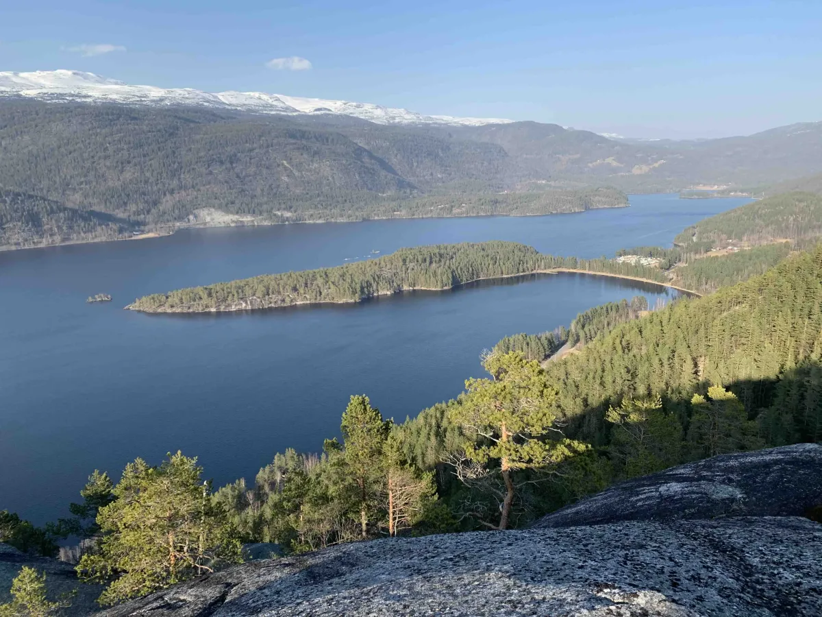
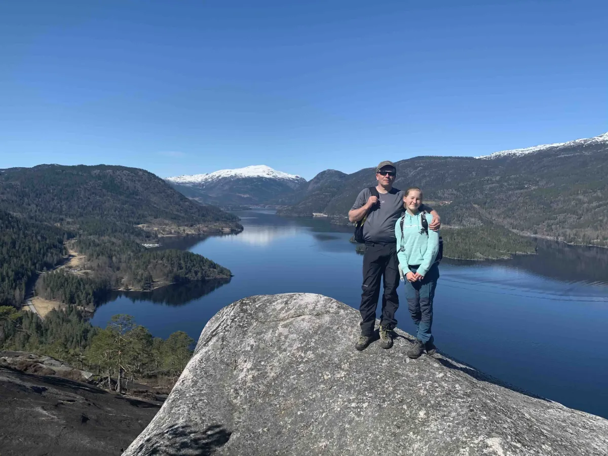
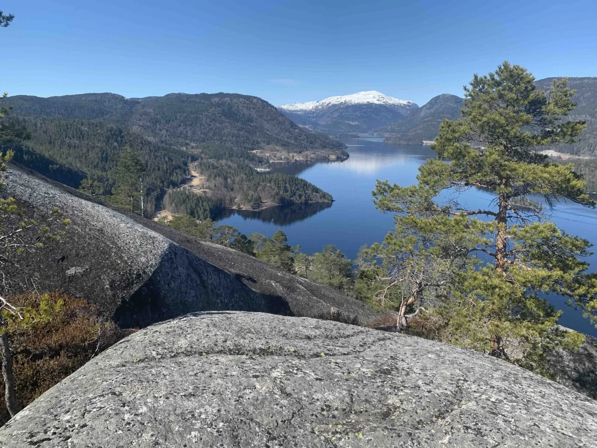
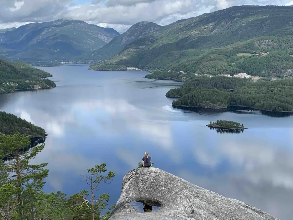
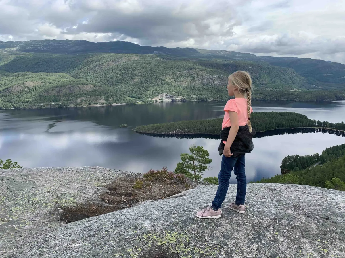
From this point, you walk straight ahead through a cut and then up over rocky outcrops towards the very top of Brennmonuten. Here you get one of the best views of Seljordvatnet:
- Bjørgesanden and Seljord at one end
- Vefall and upper Bø at the other
- Storøy in the middle of the lake
- Garvikstrondi to the left
- Telnessanden to the right
A day with clear weather gives you magnificent views and a calm mountain atmosphere all to yourself.
Facts about the hike:
- Length: Short hike (approx. 3-4 km round trip)
- Gradient: Steep - especially the last part up to the top
- Level: Medium - suitable for hikers with some experience
- Highest point: About 640 m above sea level
Hiking tips:
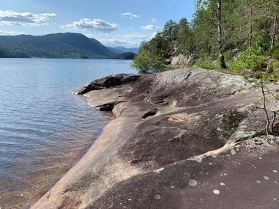
- Good shoes are important - rocks and rocks can be slippery
- Not marked all the way - bring a map or app
- Perfect for an afternoon hike with a packed lunch and thermos
- Great photo motif - for both mountains and water
Brennmonuten is one of the more hidden but spectacular viewpoints around Seljordvatnet. The hike is short and steep, and in many ways comparable to the hike to Firingnuten - a short but powerful climb that rewards you with wide views and beautiful rocks.
Starting point:
The hike starts at Brennmo, down by Seljordvatnet. From here you follow an old road up the mountainside. The road is overgrown in places, but you can still walk easily between bushes and small trees. Follow the road all the way until it stops - then you are at Østerdalstjønni, a small and quiet lake surrounded by forest and trees.
The path continues to the right and further into Oredalen. When you come to a stone wall, turn off the path and head right up the hillside. It's a little indistinct at first, but eventually a path appears that becomes clearer as you climb the hill.
From this point, you walk straight ahead through a cut and then up over rocky outcrops towards the very top of Brennmonuten. Here you get one of the best views of Seljordvatnet:
- Bjørgesanden and Seljord at one end
- Vefall and upper Bø at the other
- Storøy in the middle of the lake
- Garvikstrondi to the left
- Telnessanden to the right
A day with clear weather gives you magnificent views and a calm mountain atmosphere all to yourself.
Facts about the hike:
- Length: Short hike (approx. 3-4 km round trip)
- Gradient: Steep - especially the last part up to the top
- Level: Medium - suitable for hikers with some experience
- Highest point: About 640 m above sea level
Hiking tips:
- Good shoes are important - rocks and rocks can be slippery
- Not marked all the way - bring a map or app
- Perfect for an afternoon hike with a packed lunch and thermos
- Great photo motif - for both mountains and water
Photos (4)

1 / 4
User photos (15)
1 / 15

Practical info
- Direction
- tur-retur
- Season
- Summer
- Trail quality
- 3/5
- Solitude
- 6/5
Got any good trail tips?
Seljord
Telemark
fintur.no
Telemark
fintur.no